Overlanding '23: Crossing the Cinnamon Pass
Five trucks and endless adventures in Utah.

A good overlanding adventure introduces a manageable amount of risk. Err on the side of safety and you might as well be feeding mosquitoes in Baraboo, Wisconsin, an overzealous camp ranger checking your coolers for contraband and threatening arrest. True story. Ignore the trail warnings and, best case, you'll end up on an episode of Matt's Off Road Recovery, worst case - crushed below a few tons of gravel at the bottom of a thousand foot drop. As it happens, this year's adventure toyed with the comfort level of even seasoned overlanding veterans.
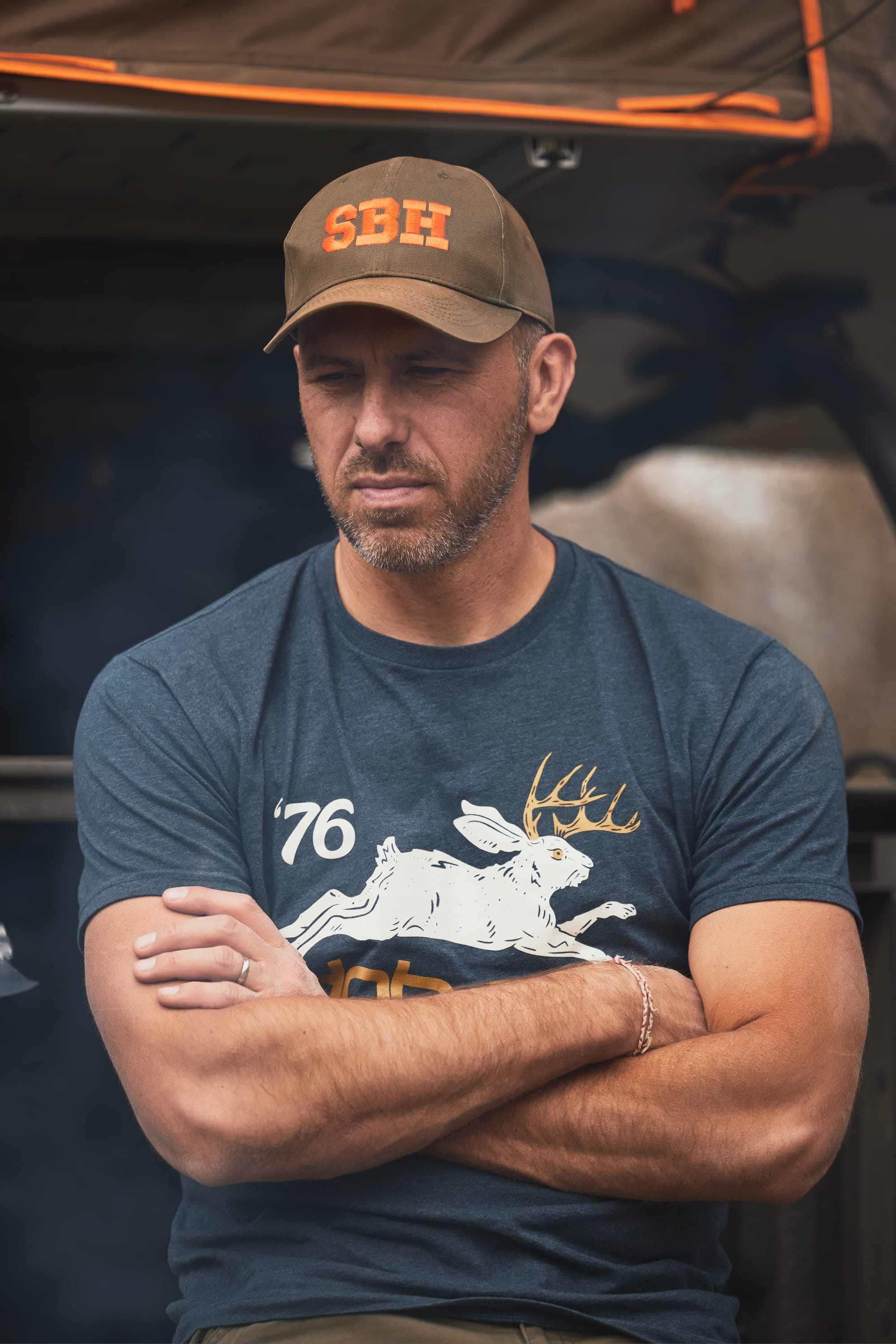
To make matters infinitely worse, I win the job lottery as the route navigator: better than digging latrine holes, but also incredibly stressful when you realize the vacation of eighteen individuals relies on your mapping skills. During planning we collectively decide to explore new trails, seek out uncharted and dispersed camping sites, and, upon ridicule of our manhood from Martin, to increase the difficulty rating for selected passages. I quote Martin, "we're not using even 30% of capabilities of these trucks". In the months leading up to the trip I spend hours plotting routes in GaiaGps, trying to walk the fine line between "fun adventure" and "call emergency services on that satellite phone". Virginija monitors the situation across my shoulder and applies her female intuition to refine and improve the journey.
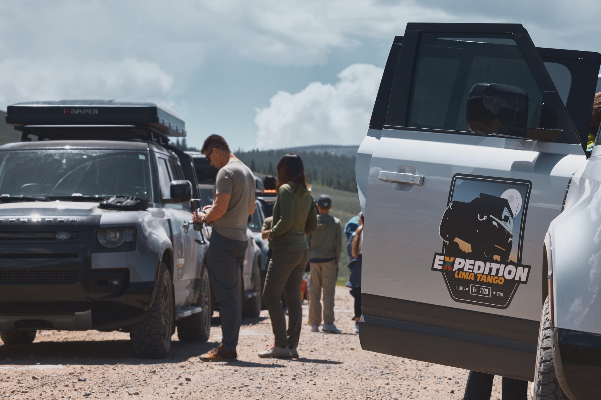
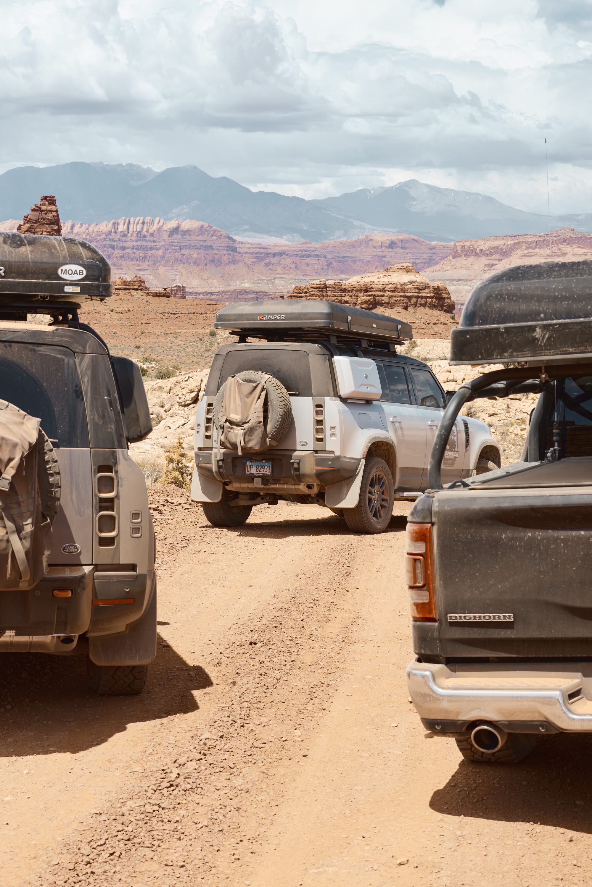
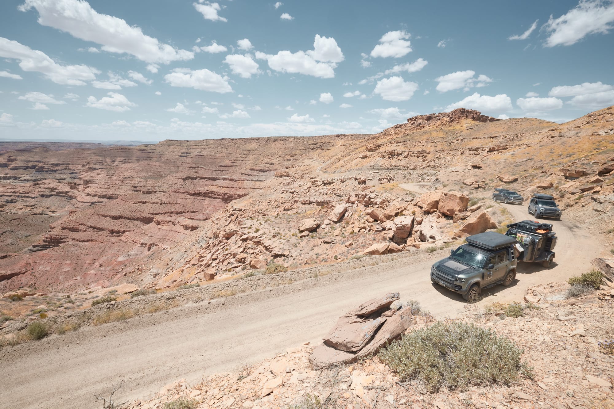
You see, this year we are turning the dial to eleven. Instead of three vehicles, a preferred caravan size for overlanding, we are humming along in a convoy of five. If that's not enough to induce a logistical seizure for Dominic, consider that one of the vehicles will also be towing a full-size, 3,000-pound trailer loaded with a dedicated shower, kitchen, multiple freezers, sleeping quarters, and close to fifty gallons of water. We're a sophisticated group of mud gypsies.
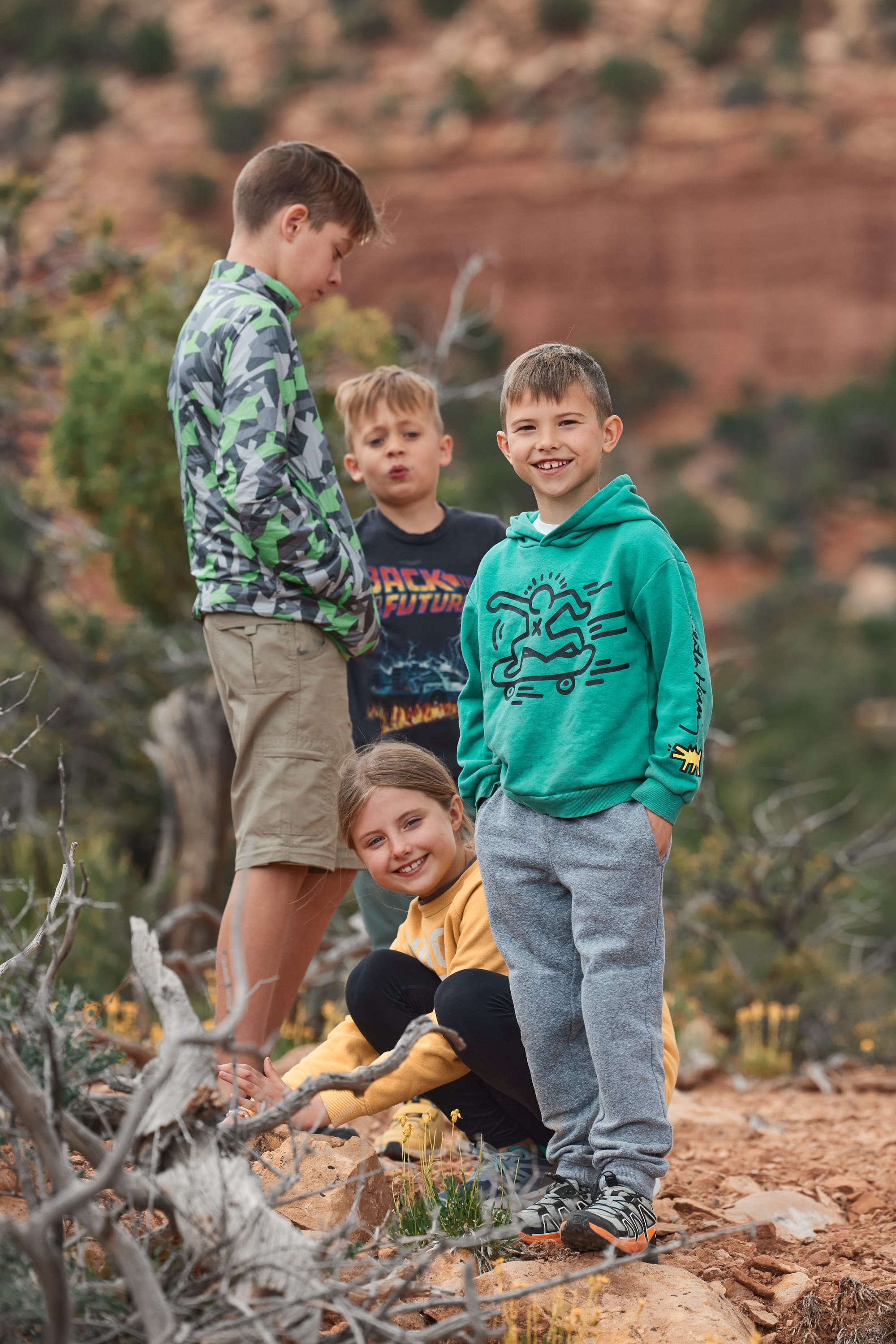
Leading up to the trip we heatedly debate the possible failures in our logistics. How many people may need to poop concurrently? Will they be able to hear each other from adjacent tents? How long will it take us to stop for a fuel refill with eight kids? How much candy can they buy at a gas station, and could they theoretically overdose from sugar? How long will it take us to feed eighteen people on a single camp stove? Unable to come up with answers we default to the one known solution in overlanding: pack more gear and roll the dice.
Our journey this year traverses the Rockies in Colorado, snakes through canyons in Utah, and finally loops back through Arizona and New Mexico. Due to unfortunate geography of our residence in Illinois, we face four days of trucking the Midwest plains (two days each way) and endless hours of ham radio chatter. As we leave through dense logistics centers in Joliet, Illinois the road opens to never-ending farmlands that stretch for close to a thousand miles. Automated highway barriers in Nebraska remind us we're crossing hurricane lands where wind speeds reach 90+ miles per hour. To put things in perspective, driving from Chicago to Denver is the same as crossing five countries in Europe on a trip from Vilnius, Lithuania to Vienna, Italy. The coffee is not as good during gas stops, but our kids find this to be the best part of the trip and descend like cheerful locust on Love's stations for sugary treats. Note: we have found that Love's and Kum&Go are the two cleanest and most versatile station chains on the route.
Denver, also known as the "Mile High City", sits at an elevation of 5,200 feet and marks the junction where great plains meet the Rocky Mountains. Thousands of miles of flatness end abruptly with jagged and snow-covered peaks of the Continental Divide. We quip about the absurdity of having to cross this obstacle with horse and cart. Unsurprisingly, the Oregon Trail, part of which we've traversed in a previous adventure, avoids the Rockies and wiggles through Wyoming to its end destination with significantly less drama. Our caravan cuts South through picturesque foothills and cattle ranches on the way to Poncha Springs, Colorado. We're trying to avoid the busy and world renown ski resorts north of us and break into sparsely populated backcountry. We regroup with the party at a small hotel, annihilate a stack of pizzas, fill our water canisters, and sleep lightly. Tomorrow marks the end of paved roads and the start of Marshal Pass.
It has been a dry and late spring this year. I don't remember the Rockies wearing this much white from our previous crossings and the melting of excess snow may come to punish us up in the trails. At 8,000 feet elevation the morning temperature is a crisp 55 Fahrenheit. The ladies exchange radio chatter about packing inadequate warm clothing while our resident pilot advises that we'll continue to lose 3.5 degrees for every thousand feet of ascent. We air down our tires on the entrance to Marshall pass – unnecessary, since the trail is a well-maintained dirt road, but it is part of the ritual. We lurch through mountain meadows adorned with graceful birch trees, sparkling and ice-cold lakes, and take the time for frequent photo opportunities.
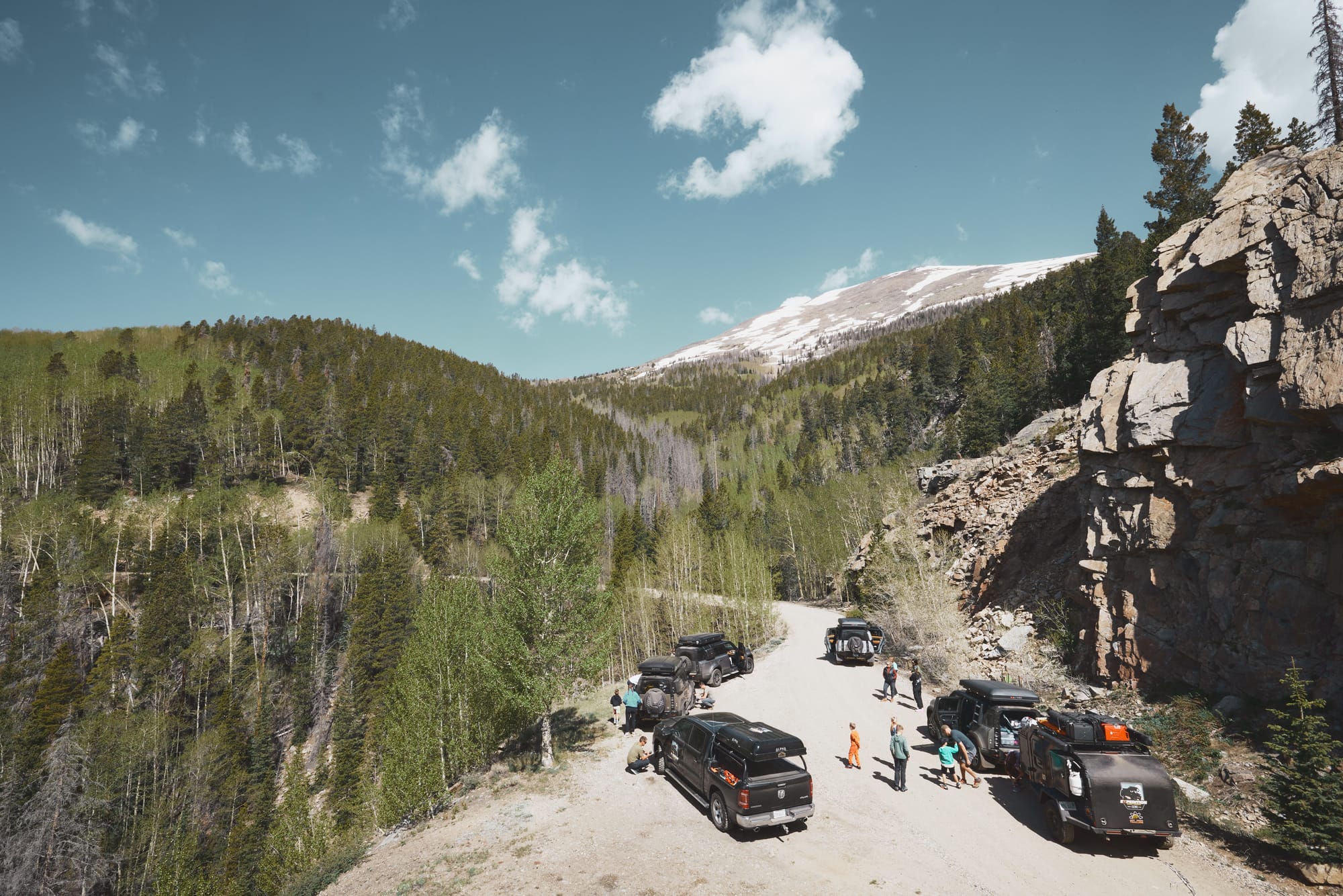
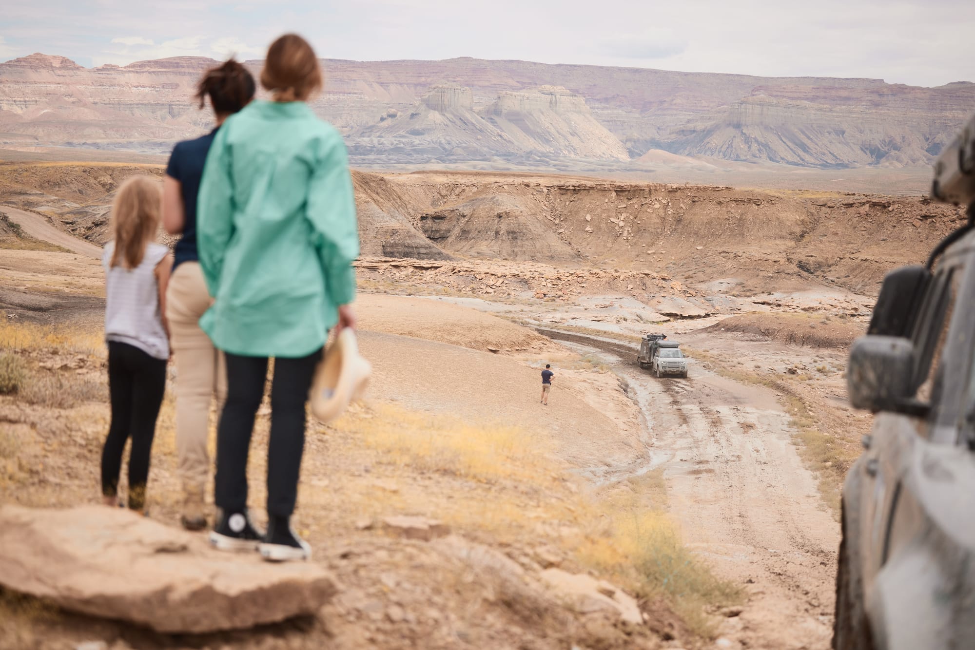
Cresting a hill we come face to face with mentioned picturesque snow, except this time it's six foot deep and leisurely spread out over our trail. I recall checking the trail status online on the national forest website and finding it open, so this is unexpected. With air suspension raised and snow mode selected, I find the Defender struggling – the snow is melting, and it collapses under the weight of the truck as soon as I set my wheels on it. Vaidas pops out of the Ram and scrambles up a hill to scout our surroundings. A moment later, he's routing us through a steep grade which should allow us to circle the snowed in section of the trail. While the vehicles are capable, seeing the horizon tilt at such an unnatural angle is not a feeling I get used to, no matter how many times we do it. We have multiple cameras rolling as we film Martin's Defender spin all four wheels and haul the massive trailer up the dirt slope, rocks flying ten feet in the air.
I have planned five to six hours of trails each day. Without knowing the conditions precise planning is impossible, but we are making good time. We roll through open meadows and settle at a picturesque spot to break for lunch. Yellow shading in GaiaGps tells me these are Bureau of Land Management lands - we can see a tidy firepit left by previous occupants and a primitive teepee that gets quickly swarmed by kids. Chewing on a piece of salami and a crispy pickle, I take a mental note that this may be a good backup campsite if we struggle to find an alternative up ahead. Always have a backup. We learned this lesson the hard way a few years back when we had to bail from a technical trail because we were losing daylight and stayed at an overpriced, sketchy motel with moldy red carpets.
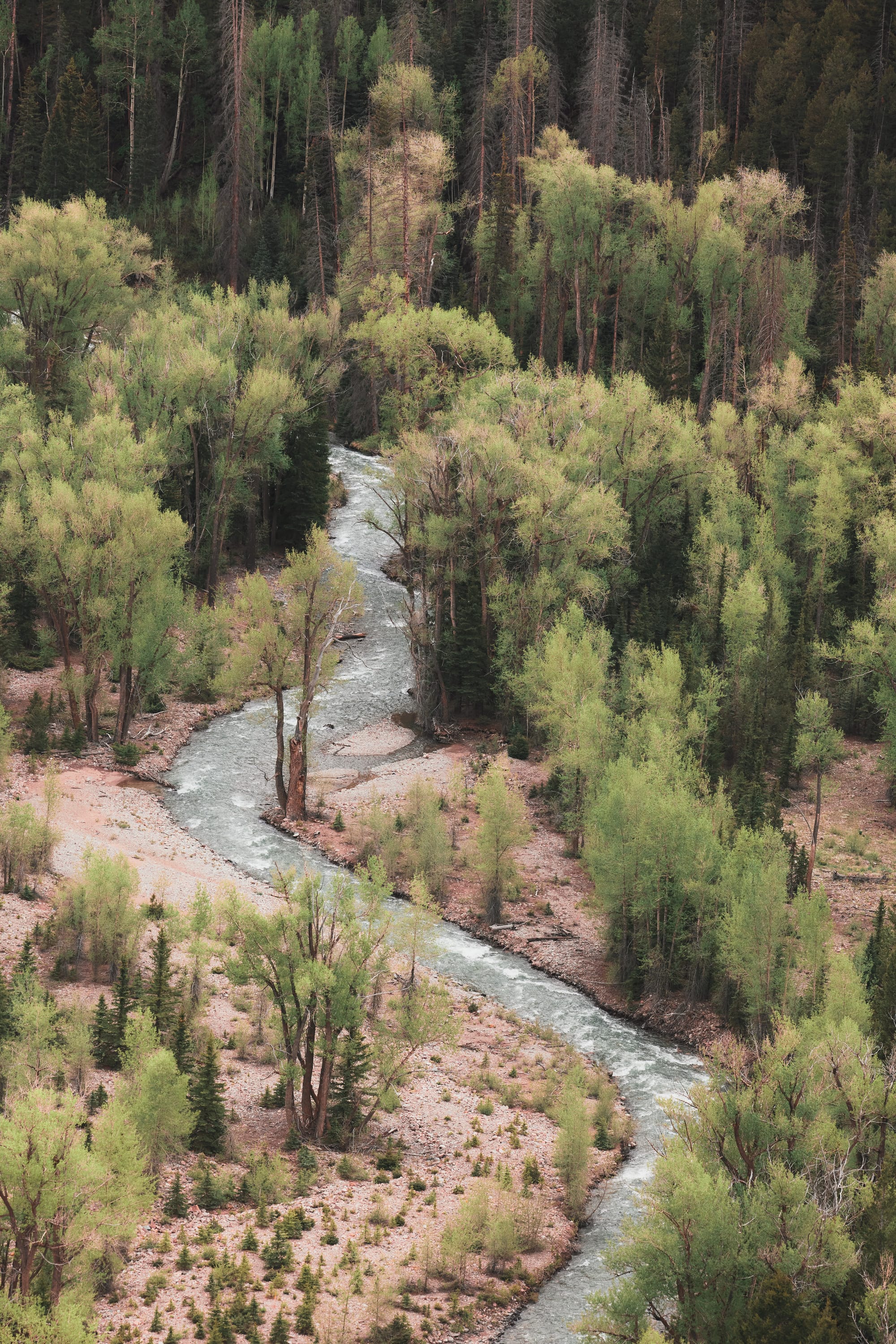
The journey takes us to Table Top road and then to Los Pinos – continuing Westbound across the Rocky Mountains on our way to Utah. Los Pinos is a popular overlanding trail as it avoids towns, stretches over the course of forty miles, and offers a myriad of aspen and pine covered camping spots next to a churning mountain stream.
Water is important. We've calculated and are hauling one to two gallons per individual per day – the tank sitting in the footwell of my Defender holds around ten gallons which should be sufficient for my crew of three for a couple of days. Lakes and streams, however, extend water reserves and eliminate the need of a field shower. Lastly, water becomes very sparse as soon as you cross into Utah, so we happily settle into a pine covered spot to camp on the edge of the gurgling stream with plenty of daylight left.
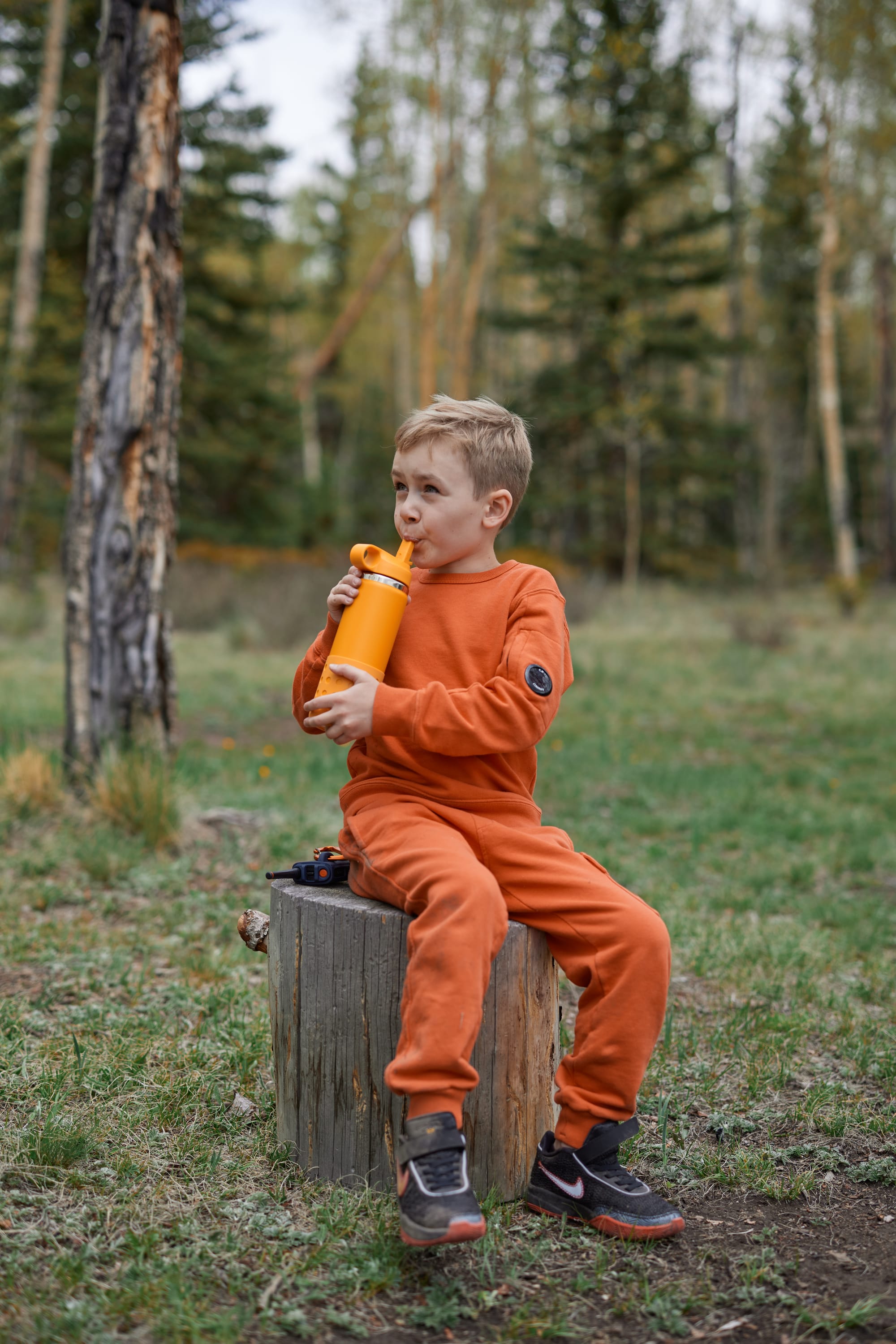
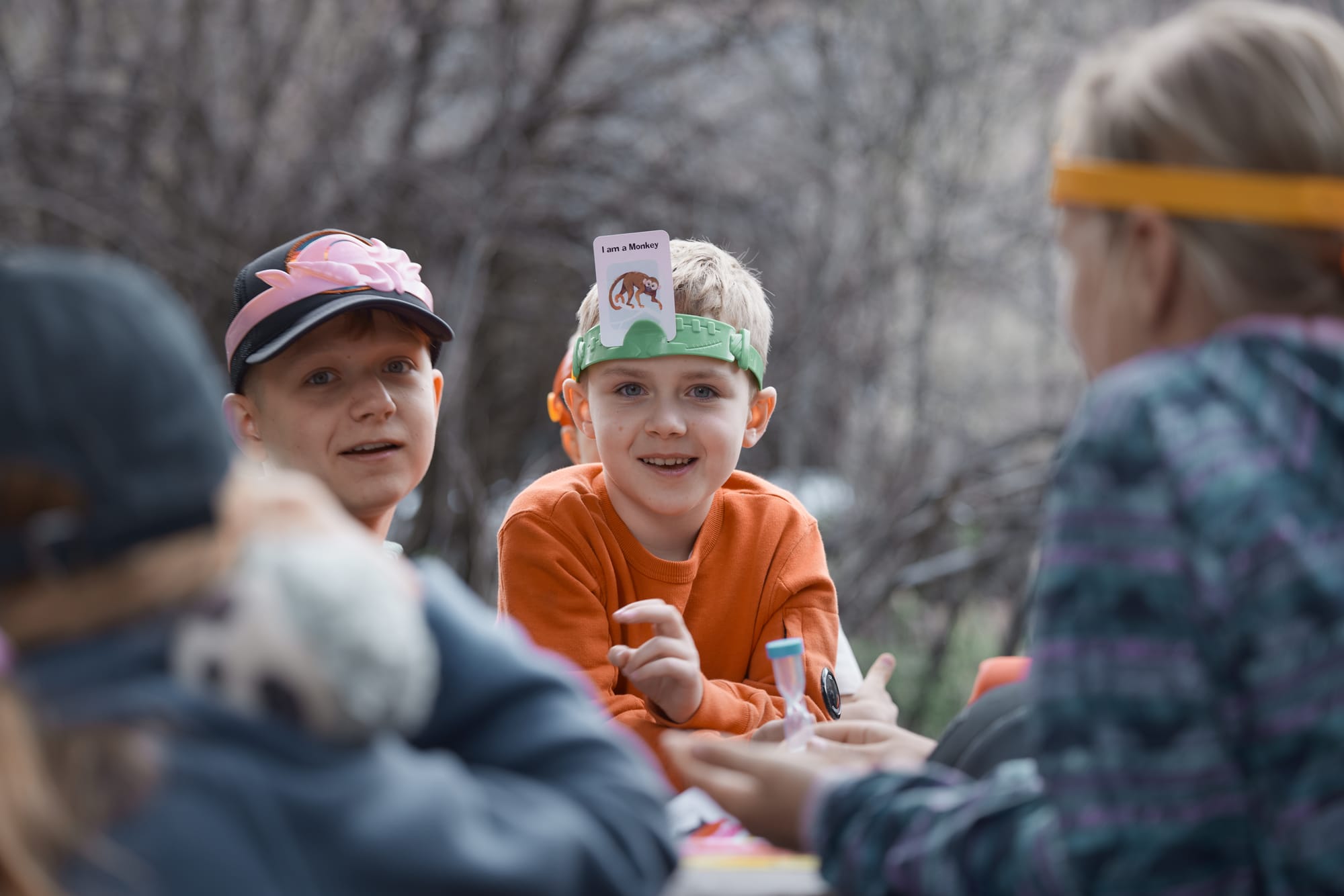
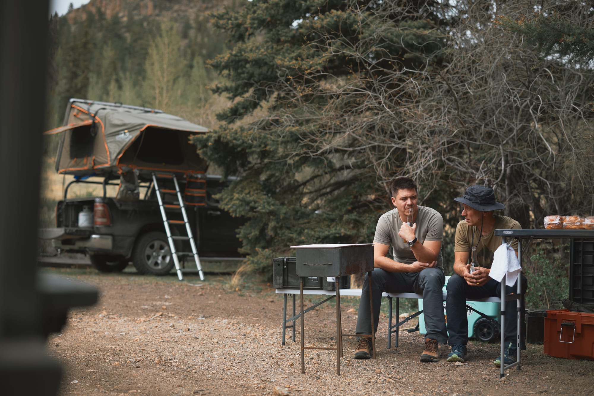
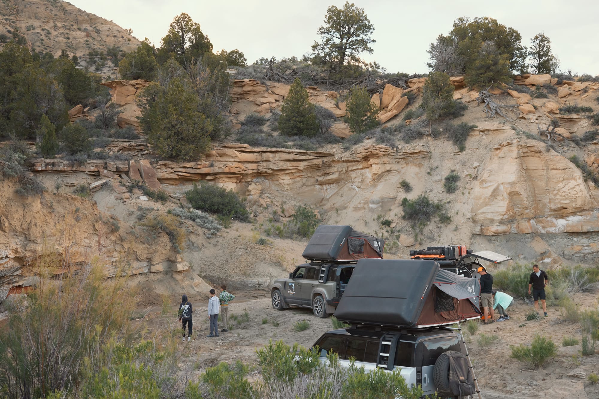
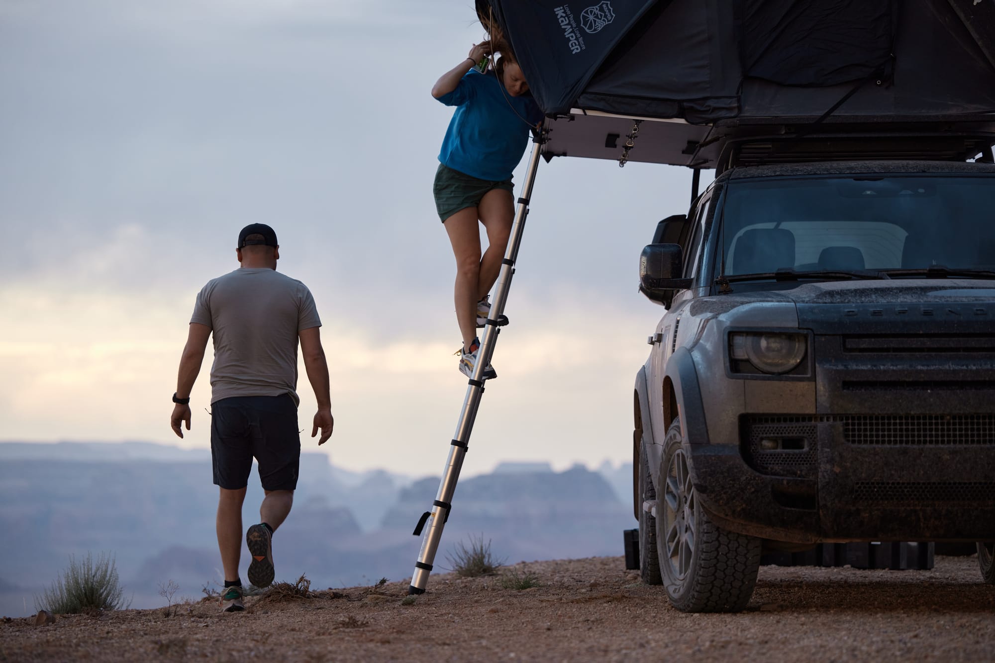
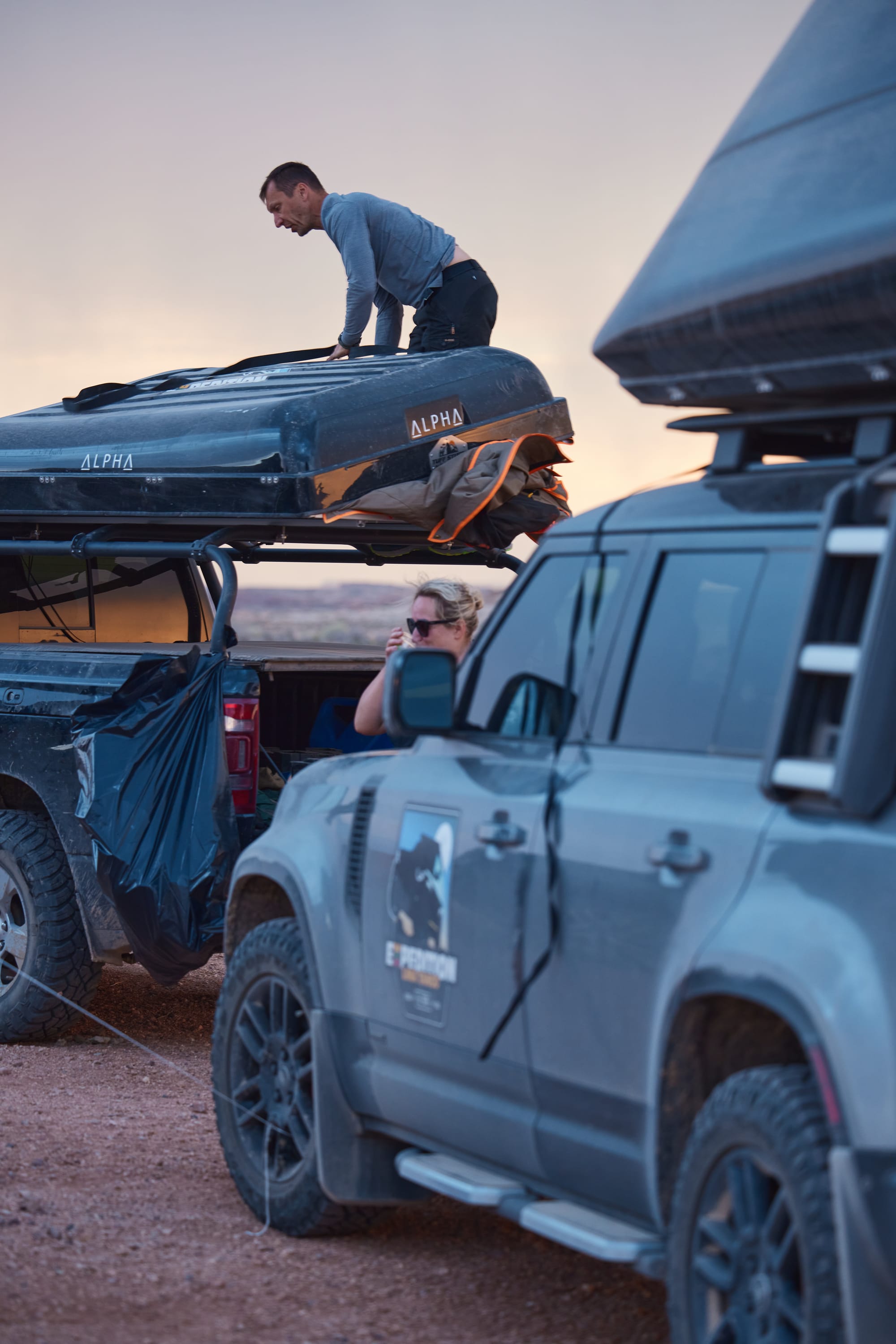
Setting up camp the first night is a clumsy affair. Some are erecting shared amenities, others are unfolding rooftop tents, everyone is bumping into each other, we're all realizing we've overpacked. The longer we spend on the trail, the more proficient the process gets. The last night of the trip Vaidas and I have the kitchen running with hot food on the table within the hour of shutting off ignition... Armed with Rocky Talkies, kids scramble up the surrounding hills while we fire up the charcoal grill and prepare condiments for burgers. Camp lights are strung from truck to track, a wood fire crackles in the firepit, laughter of kids echoing from somewhere up the mountain, I hold a cold beer in my hand and am reminded why we plan these trips each year and suffer through weeks of prep.
The night is cold. Sleeping bags perform as expected, but I've made a rookie mistake – my bald dome is a source of major heat leakage, and I haven't brought a hat to sleep in. The camp unwillingly rustles awake to the sound of opening tent zippers. Vaidas has somehow already managed to log 6,000 steps and discovered a female moose a quarter mile downstream. We're skeptical, but happy he didn't try to tame it or something. Martin pokes his head out of the tent and asks me when we're going to jump in the mountain stream, and I have to gather up all of my willpower to agree with the proposal.
There's no grace in stream bathing. To begin with, it's a foot and a half deep and I have to flop around like a beached orca to wash. The water is cold enough to make my feet cramp. But it is unlimited and better than the inevitable alternative of sanitizing body wipes, so we suppress our boyish squeals and scrub away. We tempt the ladies with a prospect of becoming mystical forest nymphs, but we've all been married long enough for them to roll their eyes and leave this nonsense to men. Half an hour later we're the cleanest we'll be for the next three days and packing camp.
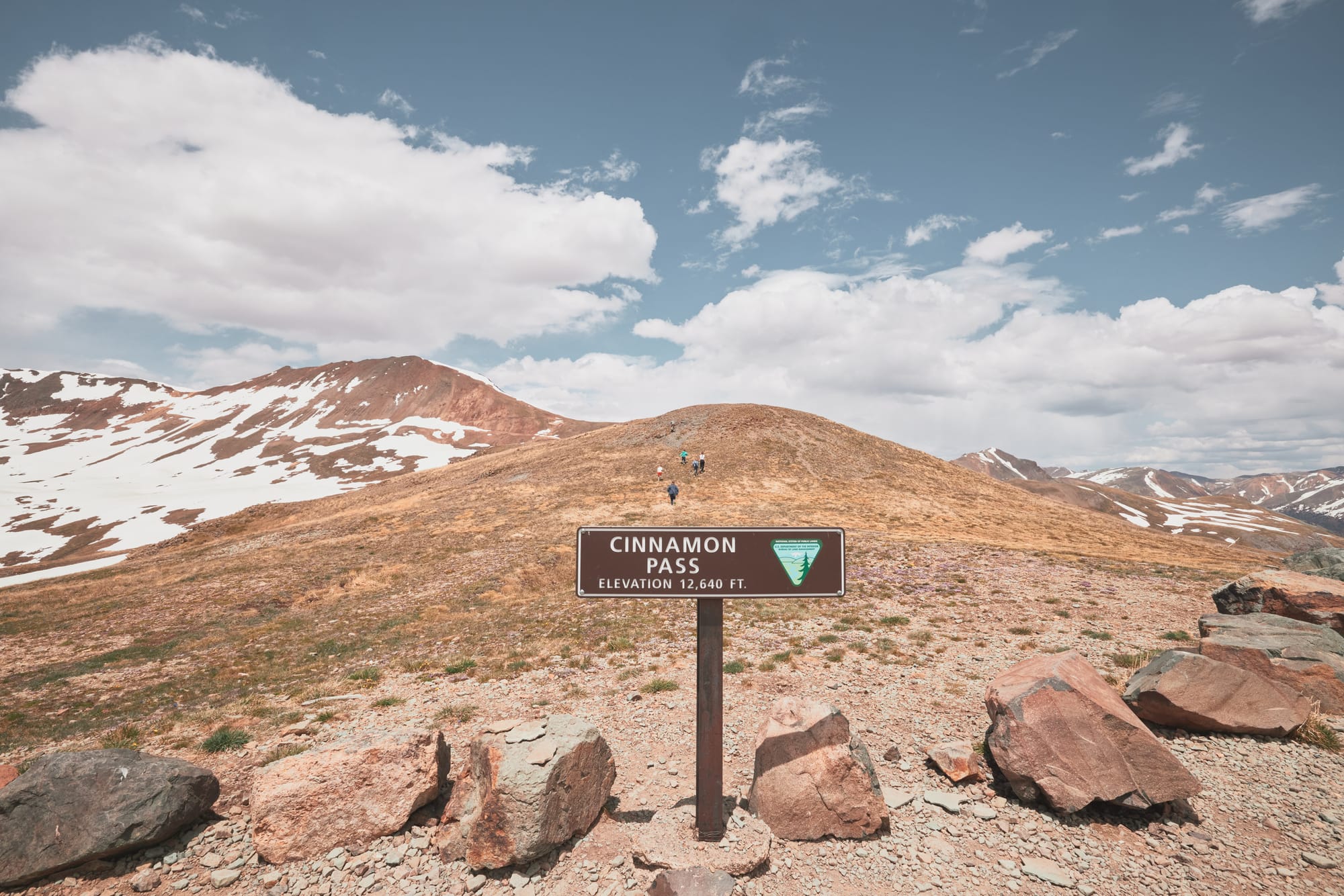
Our plan for the day is to drive through Lake City, Colorado and take on Engineer Pass – a famous trail that is part of the Alpine Loop, a 25+ mile adventure of higher complexity that takes up to five hours to traverse. We refuel our caravan in Lake City and discover from the friendly station attendant that it has been a cold spring, big surprise, and the pass is… impassable due to snow. I call the ranger station, but it's a holiday and no one picks up. Day two and the plan is already falling apart. Scrambling in Gaia I figure that we can cross the mountain range through the Southern side of the Alpina Loop, called the Cinnamon Pass. Engineer sounds more technical and exciting, but it'll have to do. We flag a local in a lifted pickup truck and are happy to find that Cinnamon Pass is indeed open.
I've shared with you that we wanted to increase the difficulty of the trip. When I had the route planned, Dominic, the ever careful and planning, researched my trails and watched a few videos from fellow overlanders. With a grave face of concern, Dominic lectured me that this was a family trip and that perhaps I've given my reckless nature too much freedom. Listening to my friend, I watch the same video and notice a bunch of kids playing on the peak of the summit. Rolling my eyes I think - how bad can it really be?
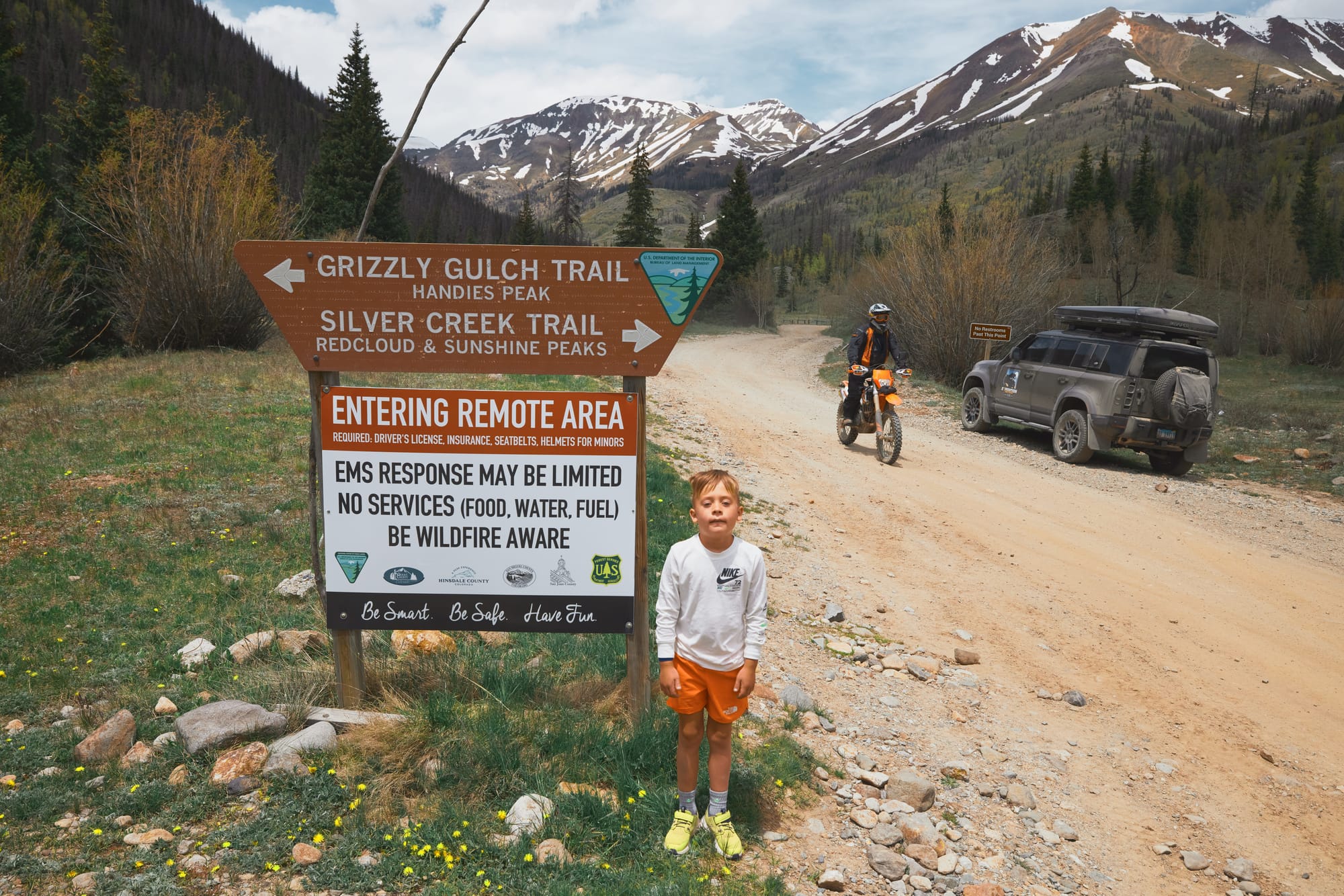
Entering from the East the pass starts with a moderate elevation increase on a rocky but even path. Grinning like children, we splash around in our trucks crossing shallow mountain streams, chatter on the radio, and stop for a bathroom break in front of a sobering sign that announces we're "Entering a Remote Area with Limited Emergency Services". Less than ten minutes later we have to stop – there has been an accident.
In a mud filled gully we discover three bikers. Two trail bikes are upright, the third - resting in the middle of the puddle, plastic body panels broken and scattered around the scene. The owner struggles to stay upright as his buddies work to clear the trail and let traffic through. This must have just happened. Giedre and Dominic are dispatched with their portable med kit to investigate and help, if possible. We're informed that the front wheel was caught by the mud and the gentleman hit the handlebars and flew over the bike after impact. Giedre sprays anti-inflammatory and painkilling substance on his collarbone, feeds the guy a few pills, but it doesn't look too bad – potentially a cracked rib or two, but the rider is stable. We're told they'll call for a tow, as their friend is unlikely to continue riding today. Unable to help further we settle back into our vehicles and continue the climb.
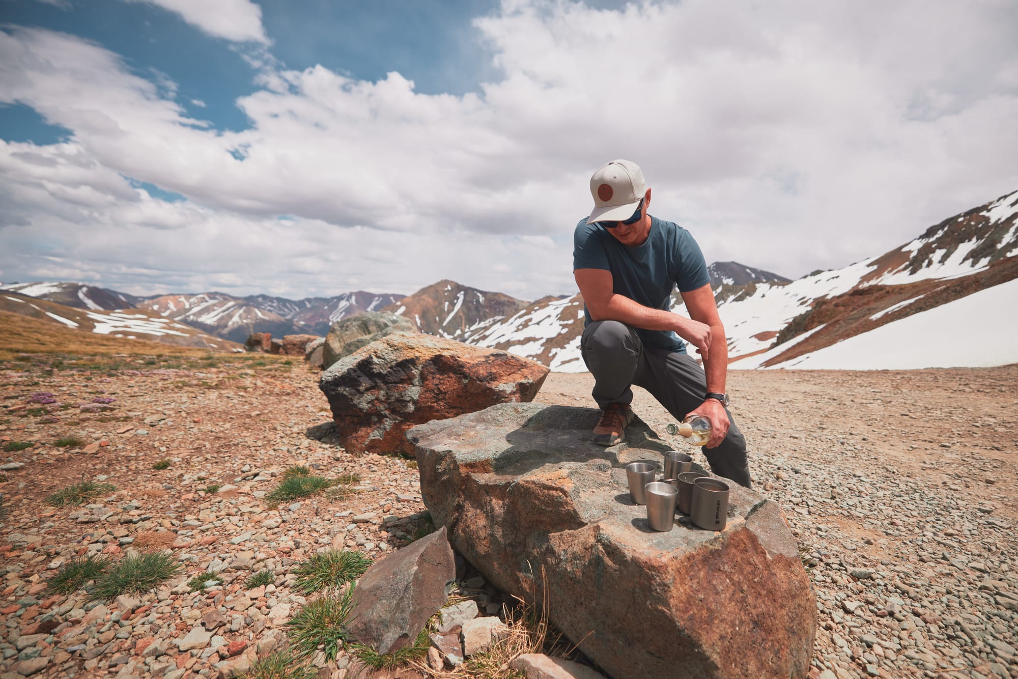
Popping bottles on that peak!
It is a slow and steep climb. Things get very real as the path narrows and the incline increases, the mirror of my Defender brushing the wall of accumulated snow on my right as I try to stay away from the long one-way drop to the left of us. The path is a series of narrow switchbacks carved into the rock of the mountain, often hugged on both sides by melting snow. The vehicles teeter on three wheels as we navigate the 180 degree turns up the pass and I catch Dominic running on the trail, guiding Martin's trailer turns in my rearview – barely scraping by through the limited turn radius. Martin has become very silent on the radio.
Further up the mountain the path narrows with little to no room for safe passing of inbound traffic. Cresting another hill, I see six Jeep Wranglers descending towards us. I don't want to imagine the necessary acrobatics were the two groups to meet on one of the switchbacks, so I speed up and ask the descending group to hold and wait. By the looks of it they are a group of rentals, middle aged couples on an adventure led by a tour guide. The open-carry, cowboy-hat-wearing guide pops out of his vehicle and comes to talk to me, frustrated with the traffic. I ask for patience and inform we're hauling a trailer up the path, which would make passing dangerous. The guides' raised eyebrows and expletives express his opinion of overlanders that bring hitched trailers up Cinnamon pass, and I have the uncomfortable feeling of underestimating the trail.
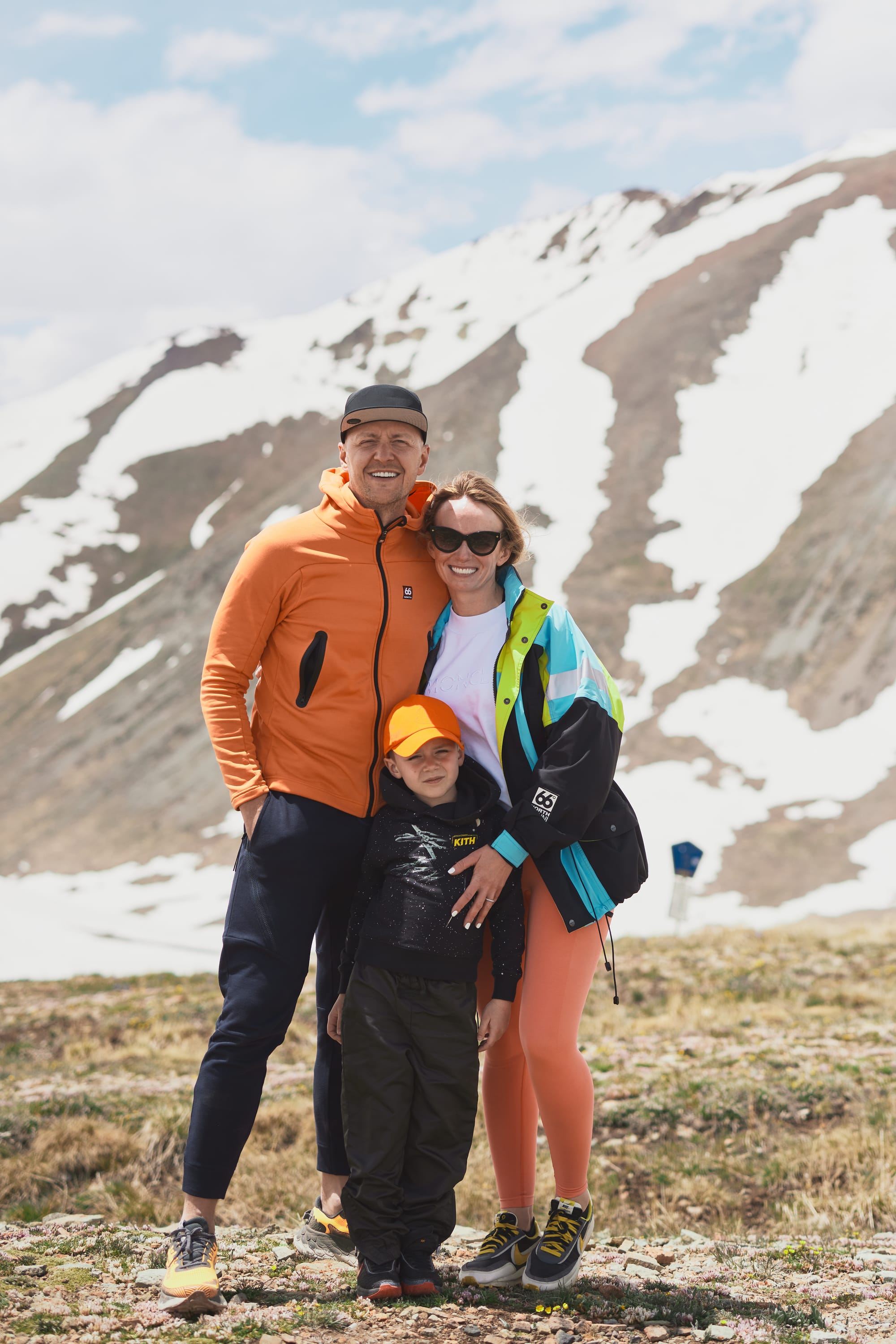
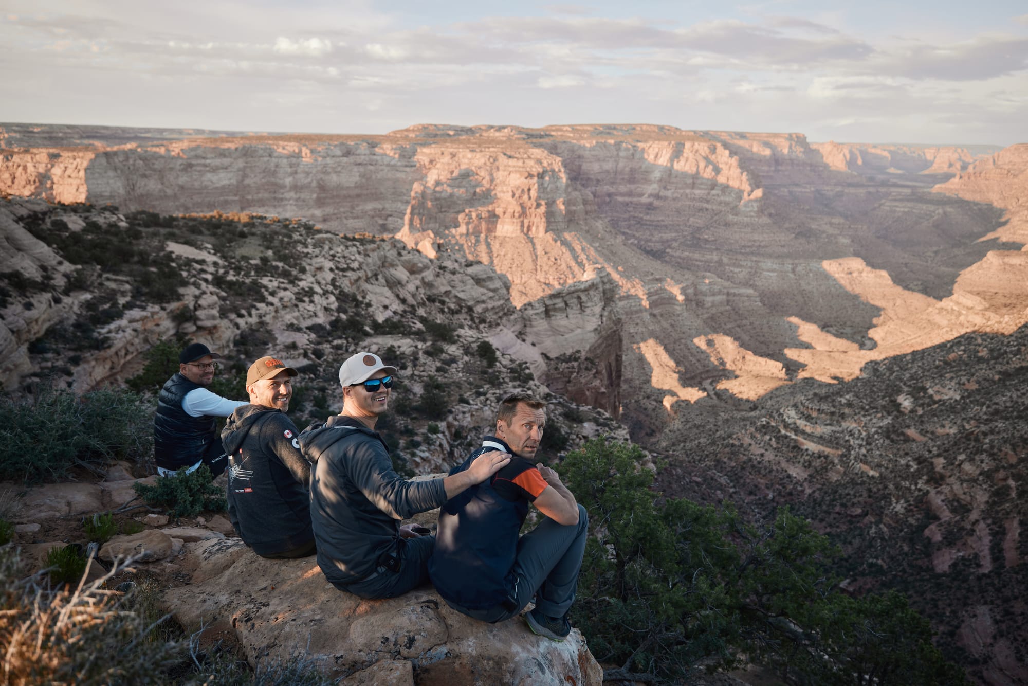
Relief is palpable as we crest the next hill and park our rides at the point of highest elevation on the pass. The narrow trails branch and expand into dull peaks of the Rockies where groups of cars are taking a breather and snapping pictures of the surrounding landscape. As kids scramble up the nearest peak, we dig up a bottle of champagne from our overengineered electric coolers and gulp down the bubbly. Gusts of icy wind remind us this is a temporary respite.
Just as we think the most arduous part is over our plan crumbles in front of our eyes. We're now four hours into the trail and after scrambling to find the right branch leading us out of Cinnamon pass we're approached by a lonesome figure on the trail. The gentleman in a bright orange cap, running shorts, and iridescent googles tells us that an avalanche blocks our descent. A brief and fruitless exploration of options such as "digging through the avalanche" is quickly discarded due to prohibitive time constraints. It's a fourteen-foot mountain of snow. To add insult to the injury, Martin's Defender experiences a side cut to one of the tires. The lesson - some obstacles are easier to scale in shorts compared to two-ton trucks.
Tired, hungry, and frustrated we backtrack to an alternative exit route from the pass and floor it to the nearest town of Ouray. The radio is silent, the sun is setting behind the mountains, and we're nowhere near our next camp site. In town, a few Jack and Coke's later the mood improves. We fight against the clock to get on the Rimrocker trail and find our next camp spot. The sky shifts in hues from the orange of sunset to light blues, to inky satin and we're still grinding the gravel trail, covered in dust and illuminated in eerie light coming from our headlights. The trucks need to keep their distance as the dust annihilates our visibility. As the last rays of daylight melt on the horizon, we arrive at a forest camp site that is still covered by winter snow. Even the fierce fire struggles to warm our weary bones on this chilly night and we quickly pack into our tents and call it a day.
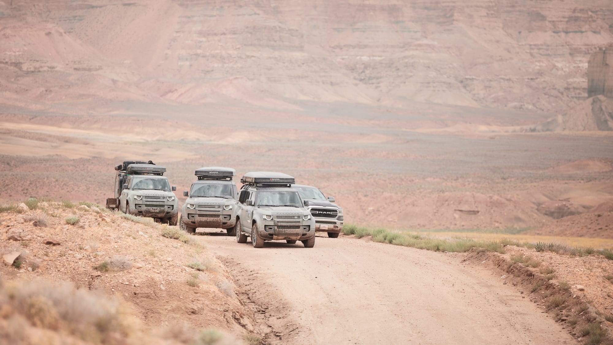
I don't typically associate cinnamon with taking a bruising – misleading name for a trail to say the least. We're down a tire and Martin's Defender is incompatible with any of the other trucks in the convoy (early Defenders did not have break clearance for smaller wheels). If his multi-ton monstrosity cuts another rubber, we're going to be properly stuck. Originally, we intended to make the transfer West using Rimrocker, a 160-mile easy trail, and arrive at Moab, but I read online that there was a chance of flooding. All variables in mind, we decide to take a half day for recovery operations – drive to Moab as fast as we can on civilized roads, repair or replace Martin's tire, refill water and supplies, and then jump back on a familiar trail that leads to our favorite dispersed camping locations in Utah, known as the "airport".
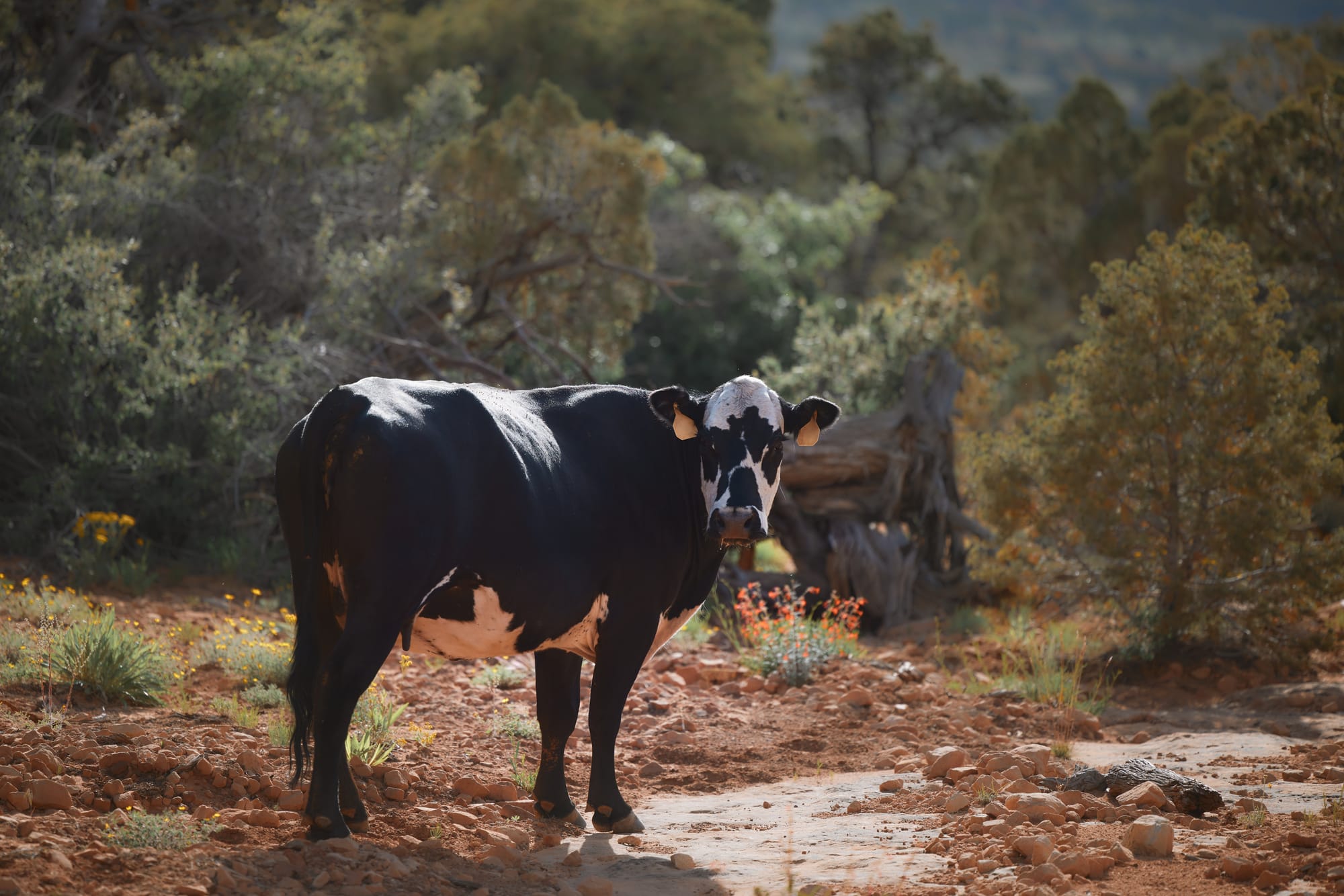
The day is largely uneventful, which is a welcome change. A shop in town cobbles up the right tire for Martin, bellies are full of subs that Saras picked up for the group, and the only significant obstacles on the trail to the airport are grazing cows that ogle us with eyes filled of surprise and bovine ignorance. Virginija has a stare down contest with a young bull blocking the path (he was winning), but our two-ton Defender has a weight advantage, and the youngster vanishes into the shrub with a shake of its massive head.
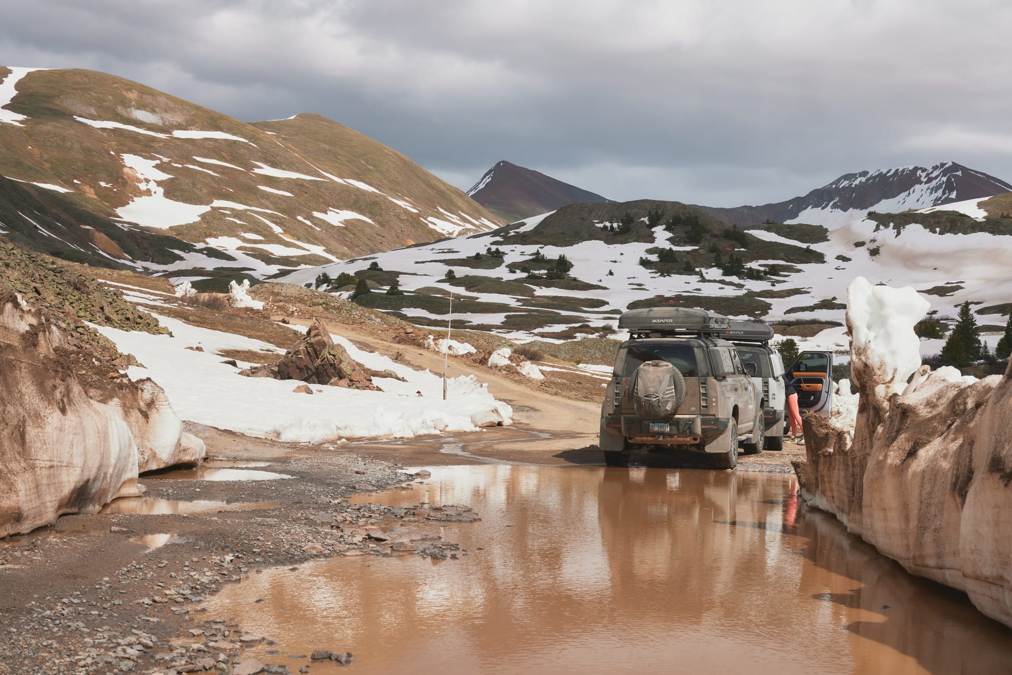
What once used to be a puddle now stands in our way as a brown muddy lake. Lower temperatures across Utah and spring rains have changed the landscape from the last few times we traveled here. Dominic dispatches one truck at a time to test the soft bank of the lake and make sure we can traverse to the other side. We do have tow ropes, but they're useless if multiple vehicles are beached. The crossing is successful, and we rumble along for a few more hours, deeper and deeper into Dark Canyon Wilderness in search of our landing strip.
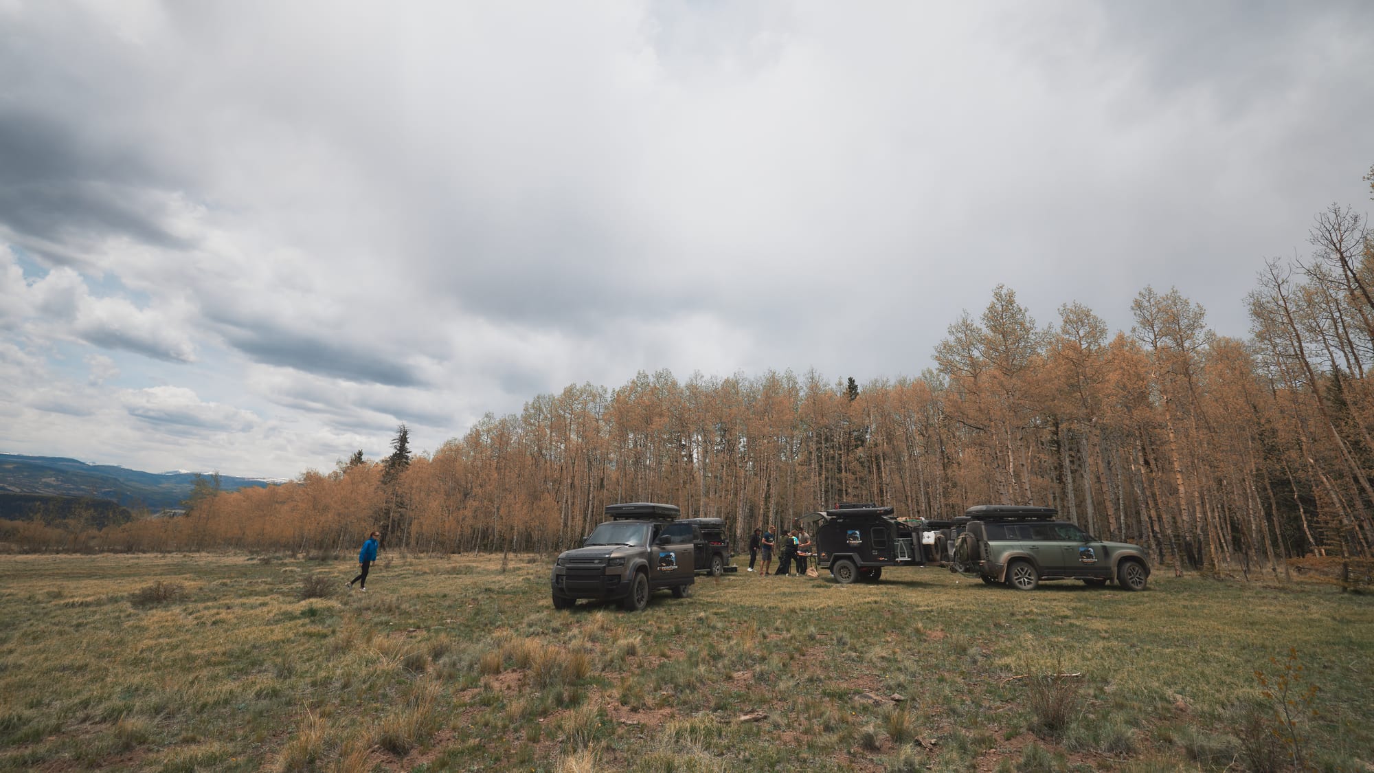
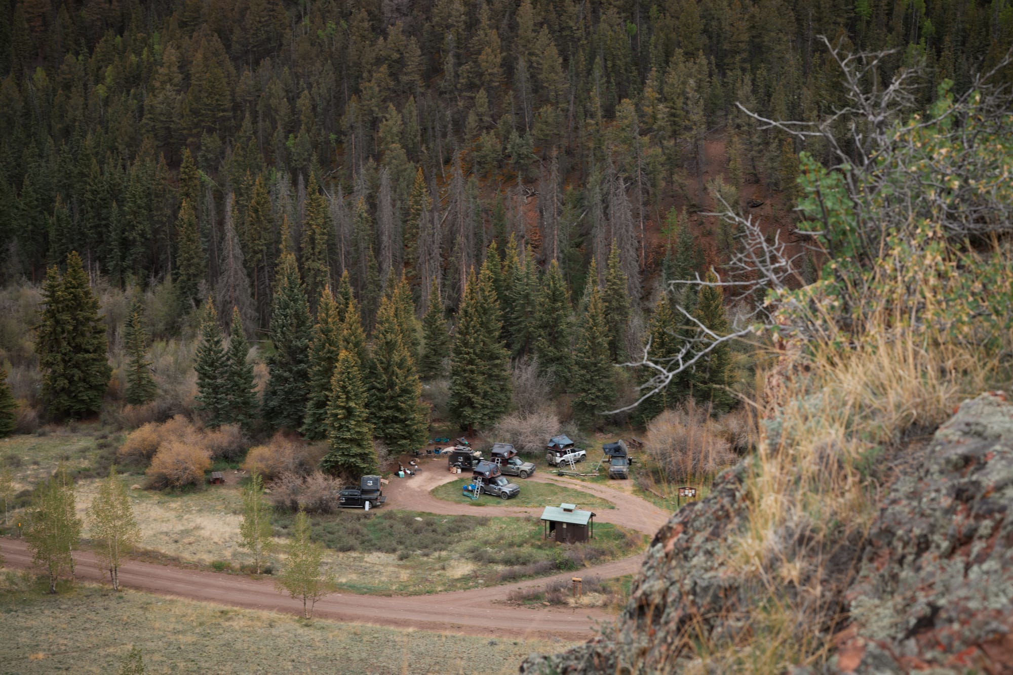
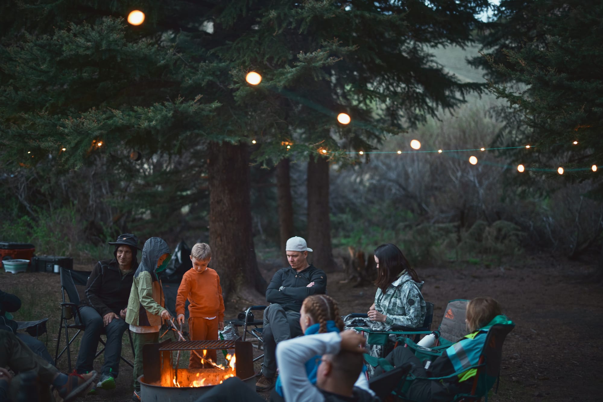
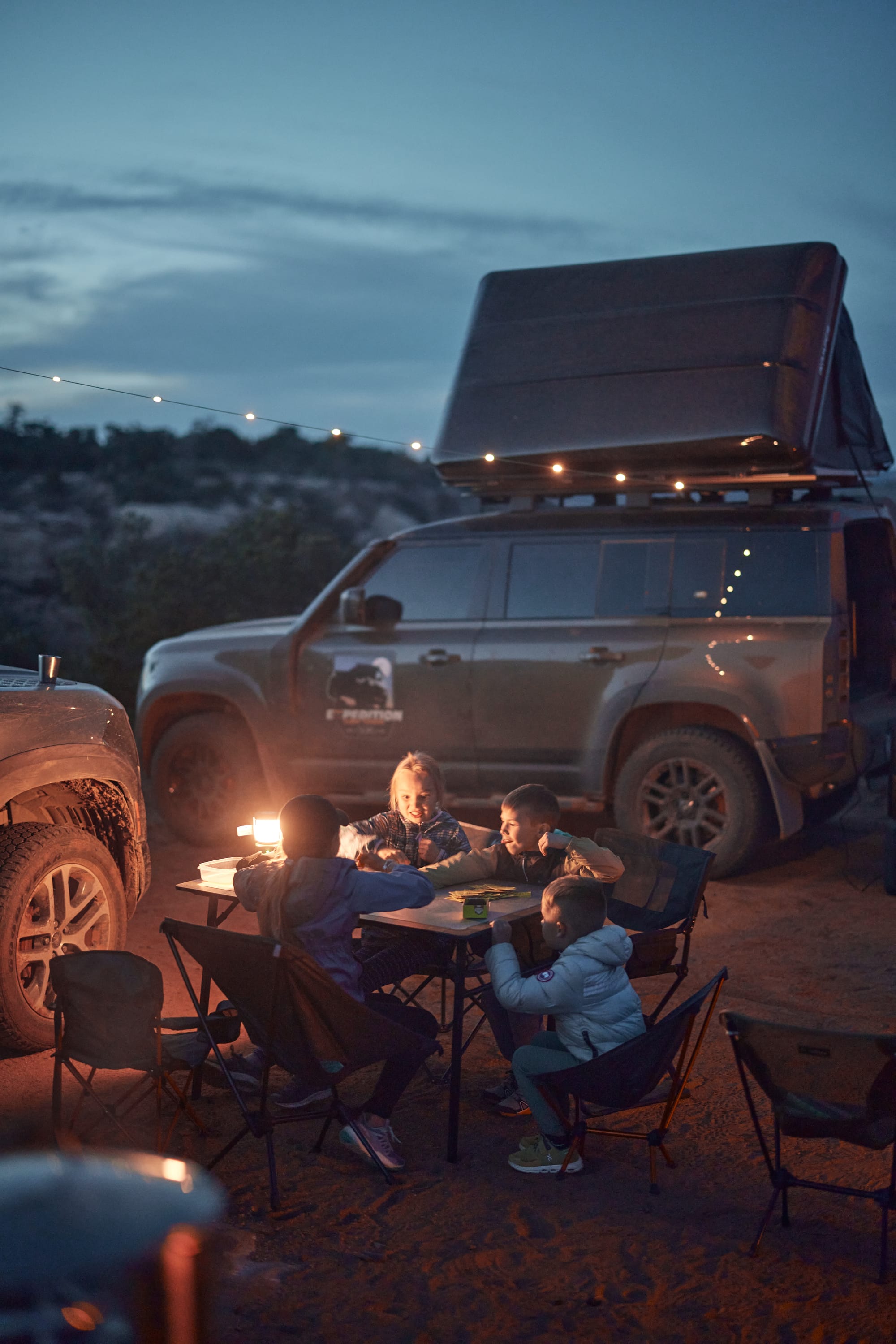
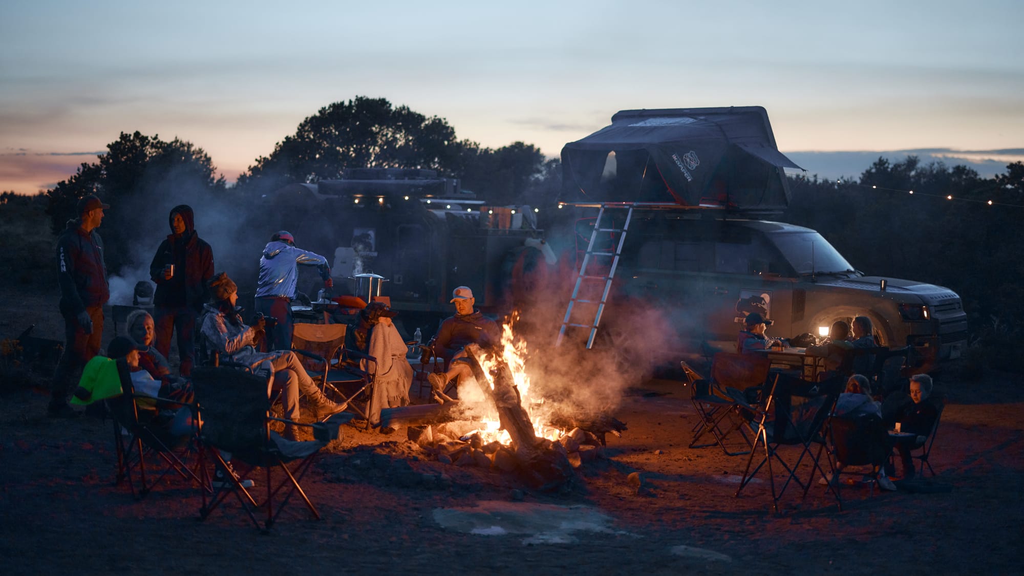
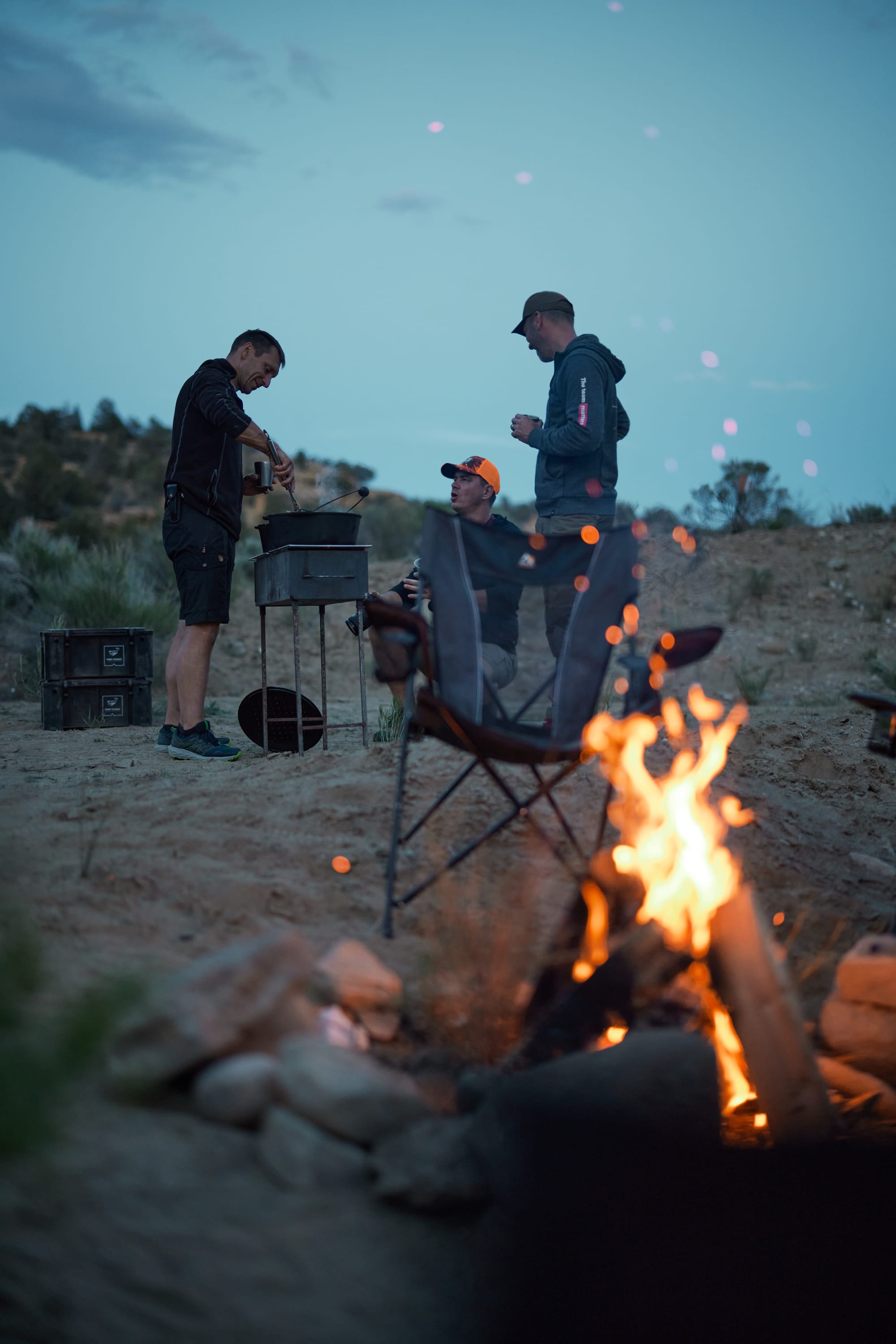
Wide open dispersed sites are the best. We park the trucks in a semi-circle and string camp lights between the roof racks – the Lucie string lights are good for over 8 hours on low output and have a solar recharge panel to get them going the next day. We're situated next to a deprecated landing strip which, we're guessing, was used by rangers a long time ago to maintain the BLM lands in the area. Dark Canyon is a remote site – a minimum of three hours in any direction to get off the dirt. I haul a few dead logs into the firepit and the resulting inferno licks the sky and illuminates our camp. Chairs are timidly pulled away from the hissing and popping fire, cold libations are sloshing in our cups, and the mobile kitchen spits out fragrant puffs of smoke as dinner is prepared for a party of eighteen.
This brings us to the topic of cooking. Vaidas and I are responsible for dinners on the trip, but cooking for a group of eighteen is a first for an overlanding trip. There are a few problems to contend with. The food has to be cooked at the same time because the evenings are cold – can't phase protein and starches into separate batches. We need to calculate how to scale each meal – this is a refined group of glampers that likes a balanced diet.
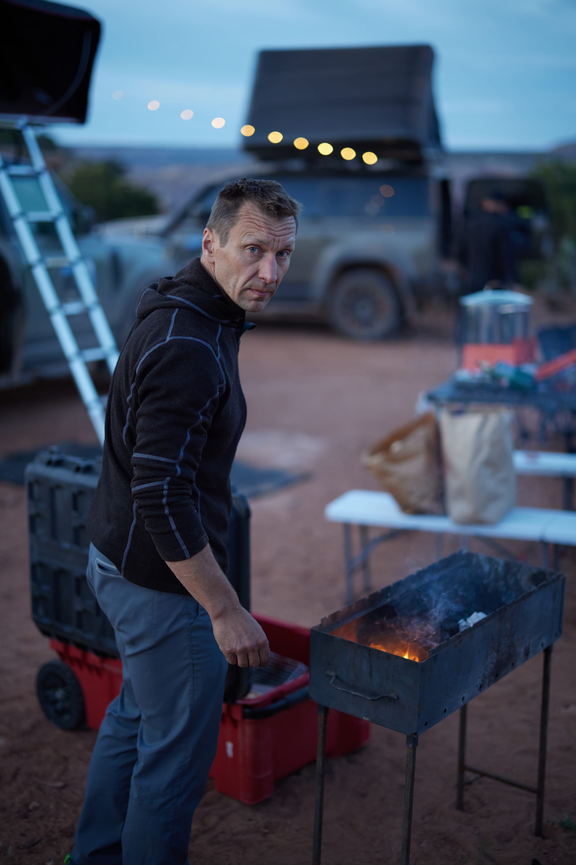
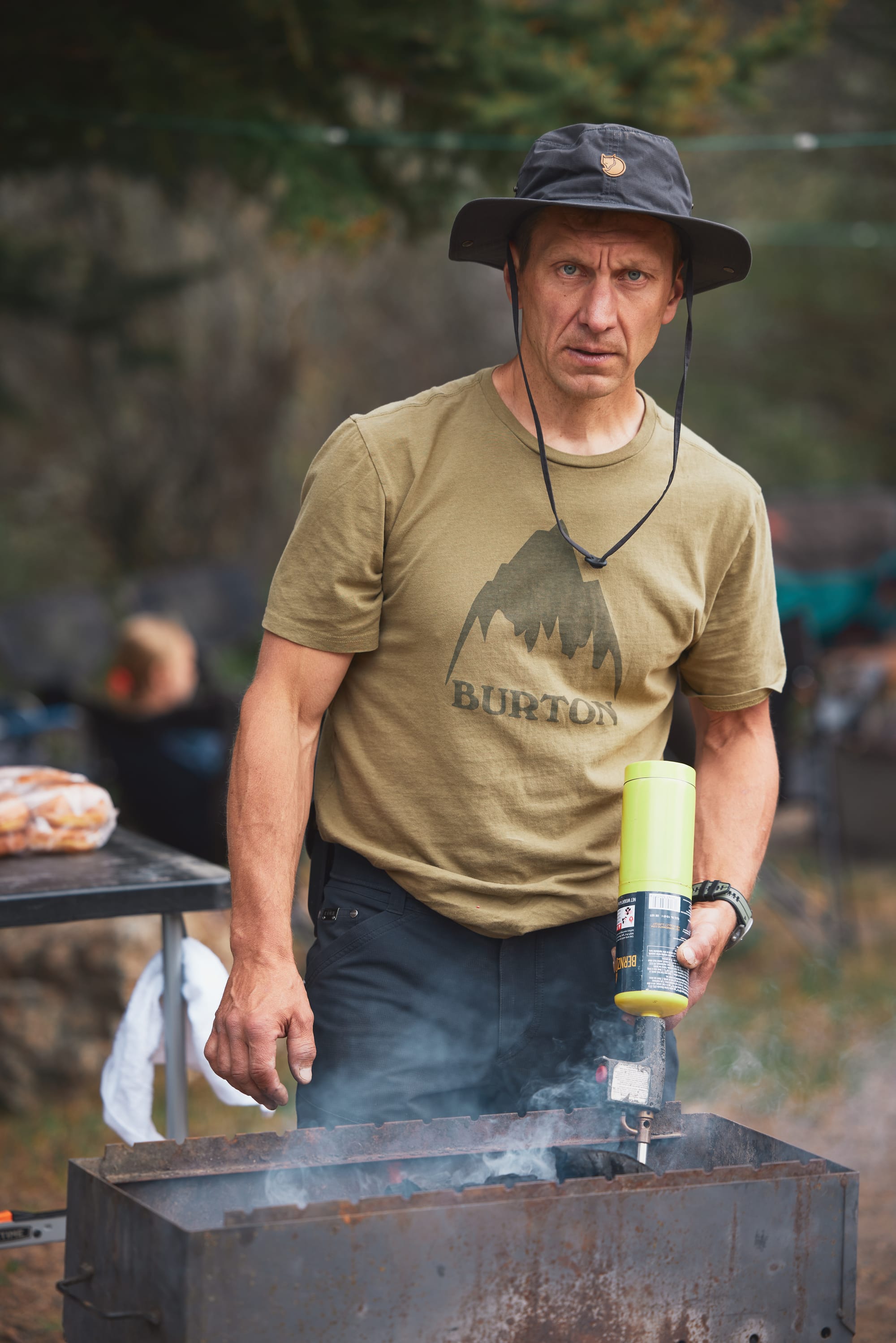
We have a dual-burner camping stove that is fueled by small, yet surprisingly efficient propane tanks. It's great for boiling things and is our go-to for morning coffee, potatoes, pasta, etc. Vaidas packed a massive charcoal grill that takes up half his truck bed – can be used for direct fire or for setting up multiple pots. Our primary cooking vessels are large pots and Dutch ovens – they're versatile to accommodate boiling, frying, and slow cooking. Each dinner is typically a coordinated prep of a protein (sausages, stews, grilled meats), a carbohydrate (mashed potatoes, rice, pasta), and some type of green to balance it out. Add some herbs, spices, and field-made sauces and the camp falls silent, relishing in caloric surplus.
Before I forget – if you're trying to boil water and it's taking forever, check if your tank is running low on propane. The stove will have a flame, but the low pressure in the tank will mean that it'll have trouble putting out the needed BTUs. Lesson learned the hard way. With the whole camp complaining about a late dinner.
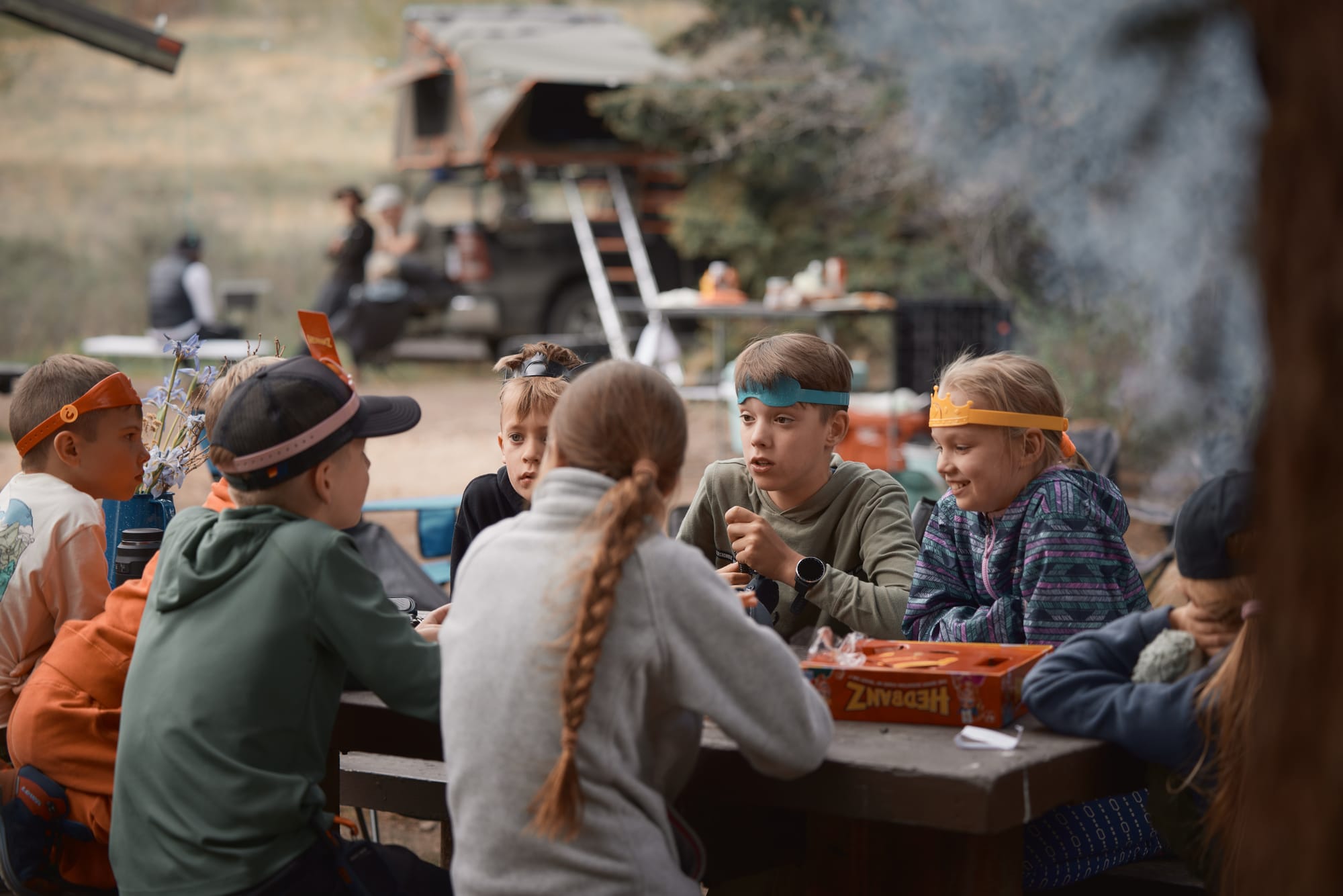
This evening is a misleadingly pleasant respite from the sketchy crossing of the Rockies. It's cooler in the desert, but nowhere near the freezing temperatures we suffered yesterday. Bellies full, kids have set up board games on folding tables, adults are nursing drinks, dispersed by the fire. It's close to midnight and, stifling a yawn, I check with Virginija if it's acceptable for me to bail and crash in the tent. Sensing the inevitable end of the evening, kids start chasing each other around the vehicles, their vitality trying to juice every waking minute of adventure out of the night.
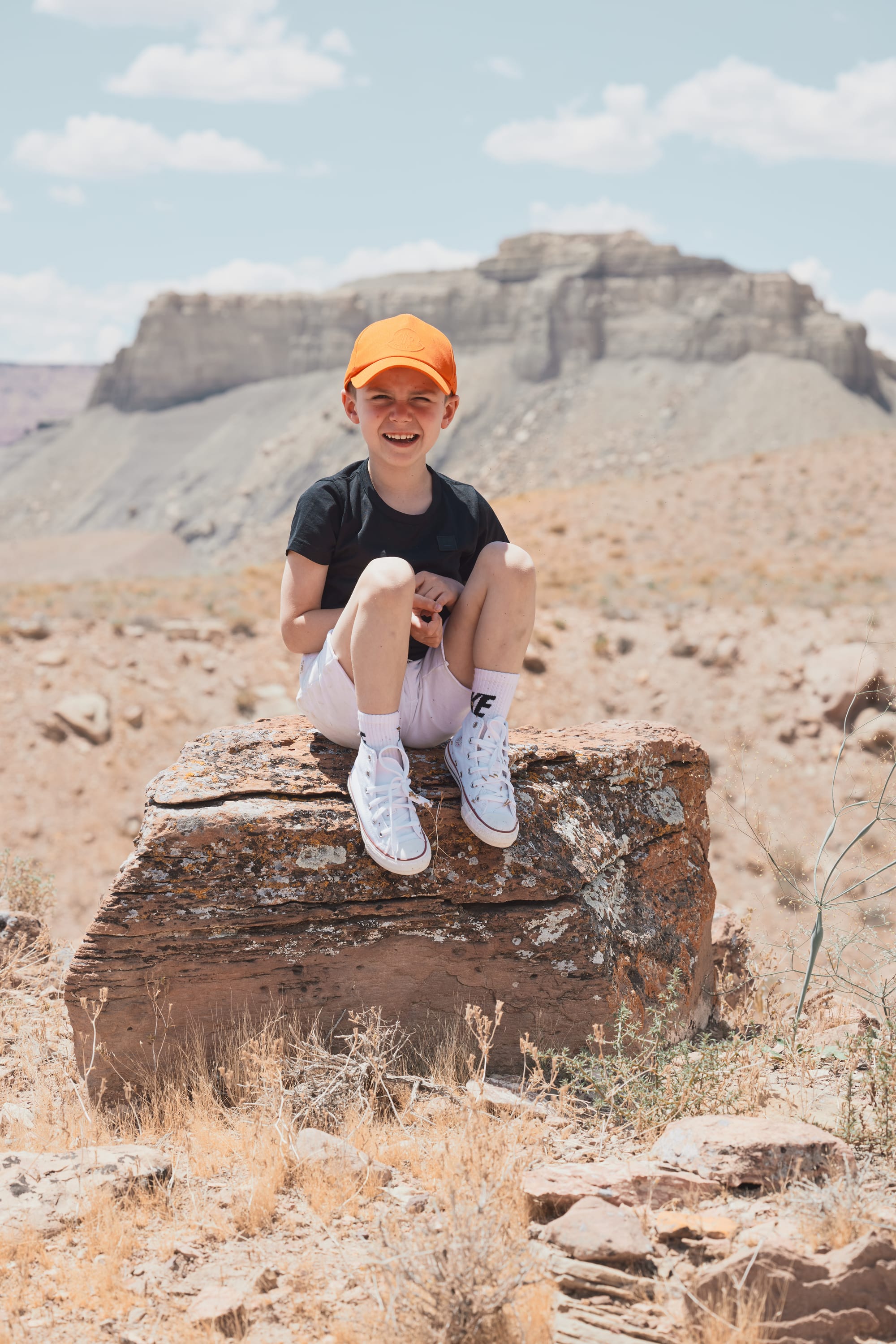
Even in present day I get chills trying to describe what happens next. We hear a child screaming. Instincts kicks into gear and all parents are on their feet, scrambling to diagnose who and where is hurt – that's not a band-aid type of sound. Viktoria is the first at the scene and calls out that Sebas, a seven-year-old boy, hit his head on an open car door and is bleeding profusely.
We have a bleeding kid with a head wound, we're in the middle of nowhere with no mobile reception, and we're not sure any of us should be driving at this point. It's a nasty two inch cut on the head, but the bleeding stops quickly and Sebas is not showing any symptoms of a concussion. With Giedre in the lead we use clippers to give Sebas a quick haircut in the area of the cut, a field dressing to hold together the affected area, and bandage the little dude's head. Shaken, we discuss options and based on Sebas' condition decide to route Sarunas and family to Moab early in the morning for an ER visit. Even though it doesn't feel like it at the time, all is well that ends well. The family make it to the ER office and the doctor compliments the field medical team on our professionalism. They take a much-needed rest day at a hotel and courageously rejoin us a day later down on the trail.
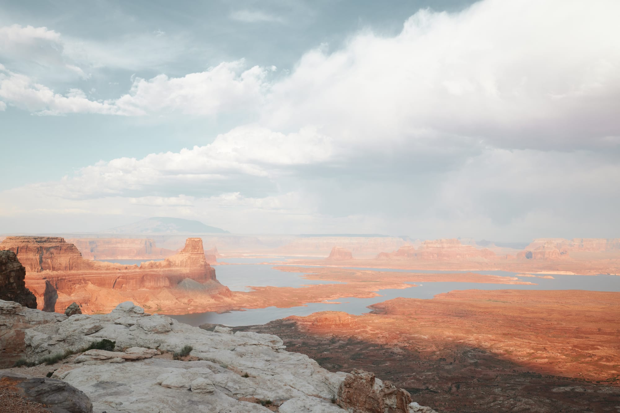
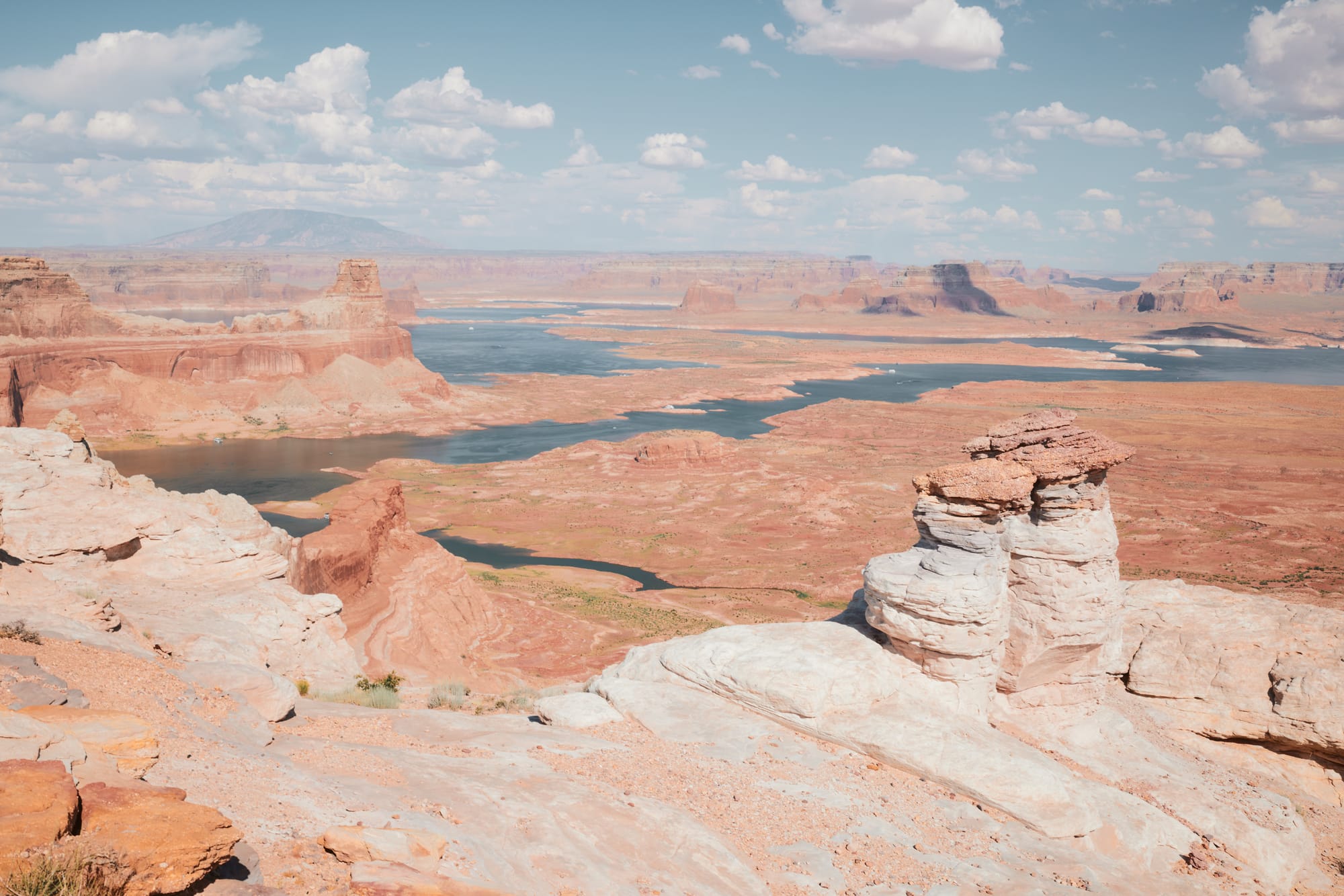
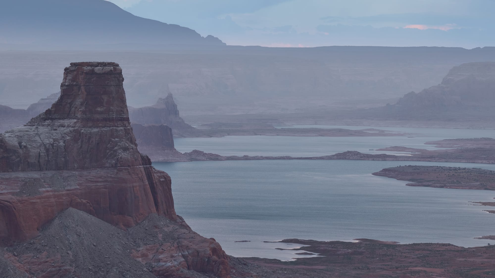
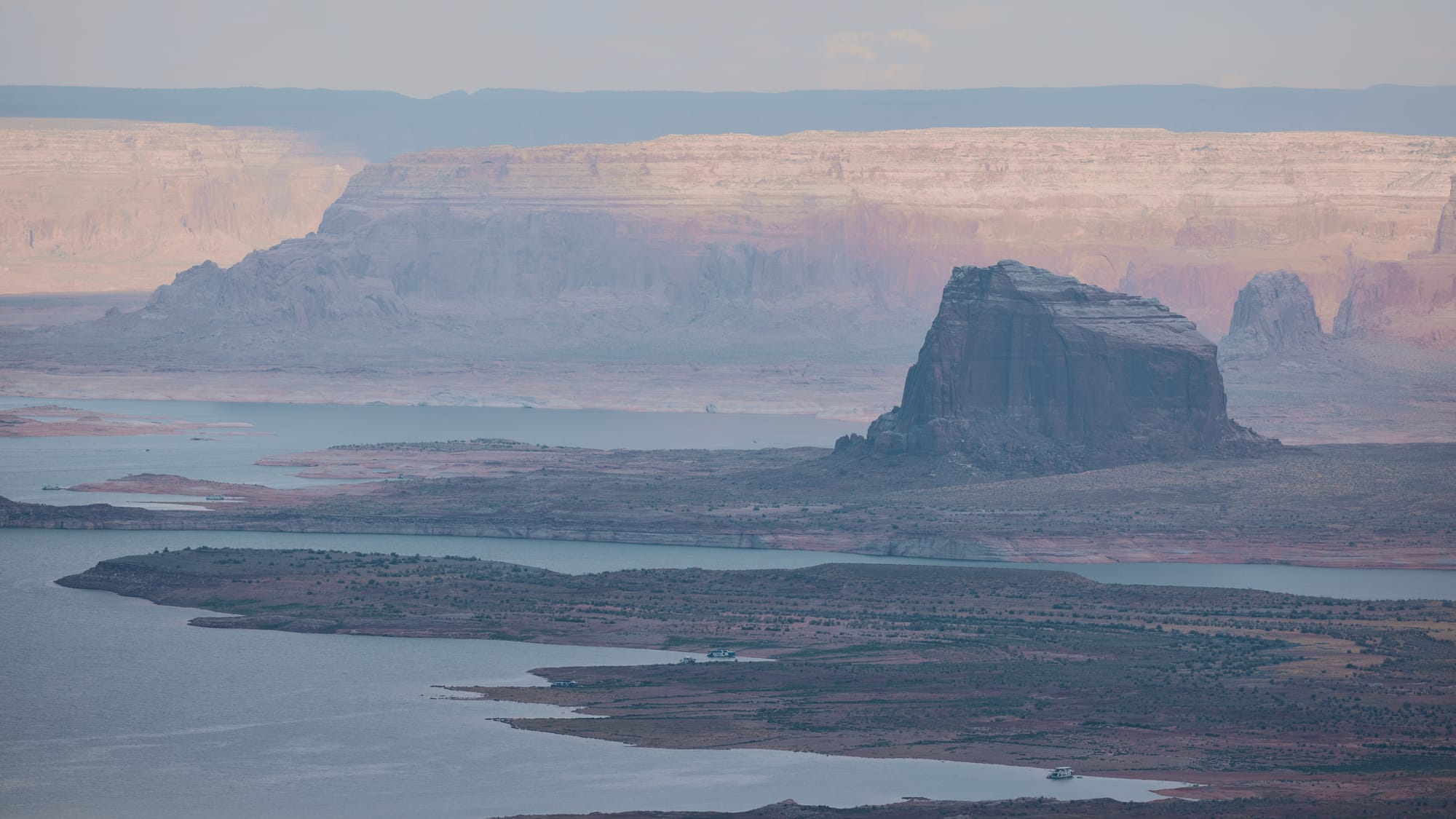
When we planned the trip with Virginija she was adamant that we make it out to Lake Powell – it's an incredibly picturesque area surrounded by decaying canyonlands on all sides, bordering with Arizona and our Westernmost destination on this trip. It would take us a couple of days to get there – follow the trail out of the "airport", resupply at Escalante, then cross a wide swath of wilderness to the Northern side of Lake Powell where we would spend the night before our final approach.
Our injured crew mates leave us in the morning with screenshots of map directions taken out of the Gaia app. There's no reception out here and no easy way to route a solo vehicle out without offline maps. Everyone at the camp is shook up from last night and we don't rush the morning, eat a slow breakfast, assemble Martin's advanced outdoor shower and expend some of those fifty gallons of water we've been hauling in the trailer to peel off three days-worth of road dust. Funny how luxurious liquids feel in the desert.
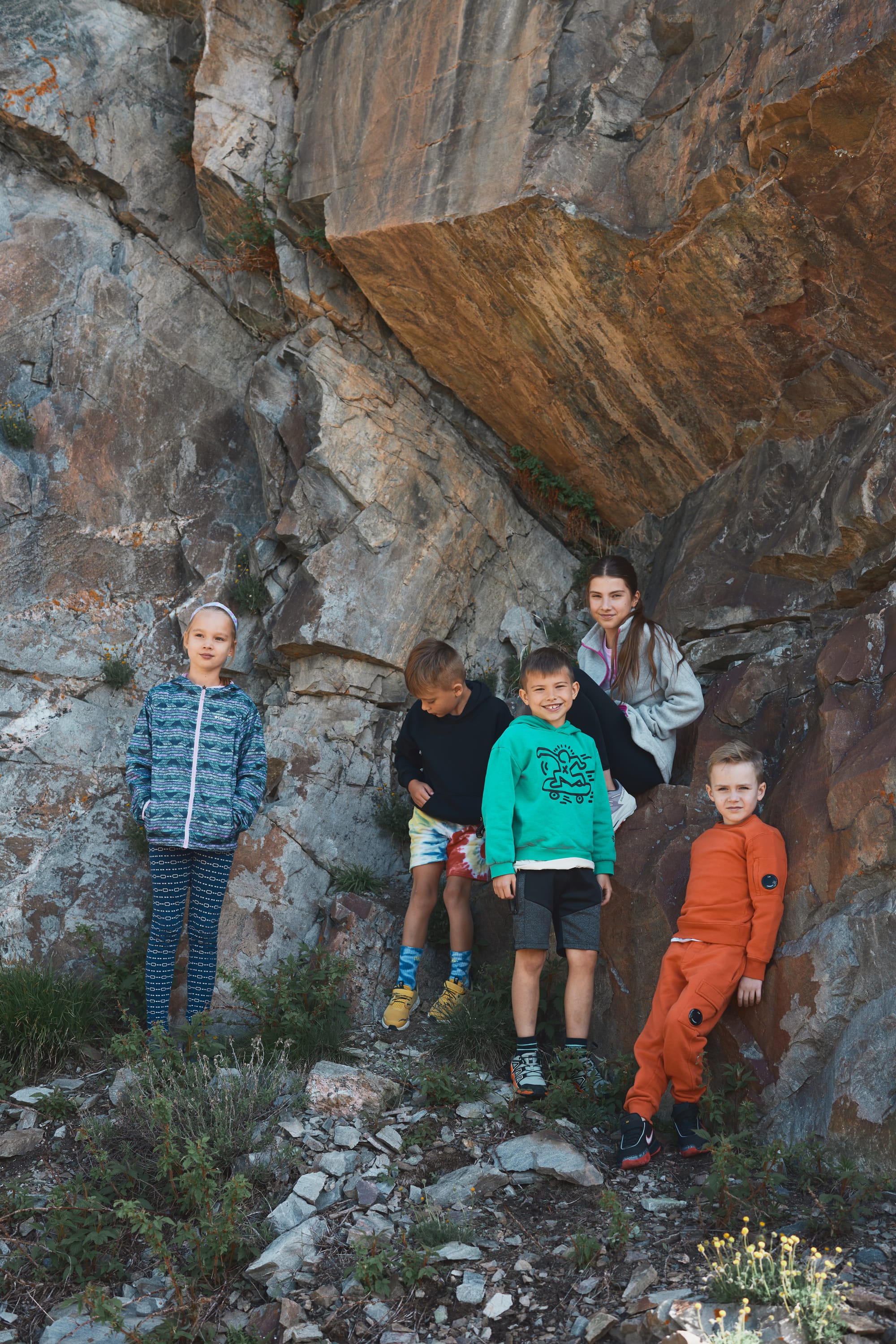
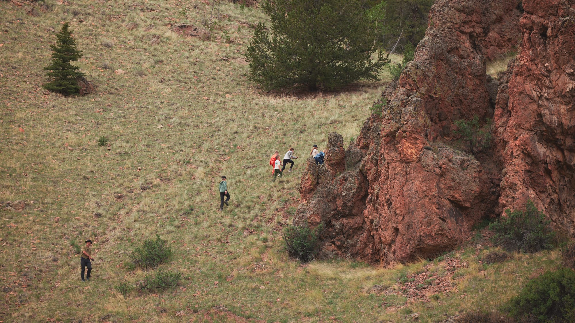
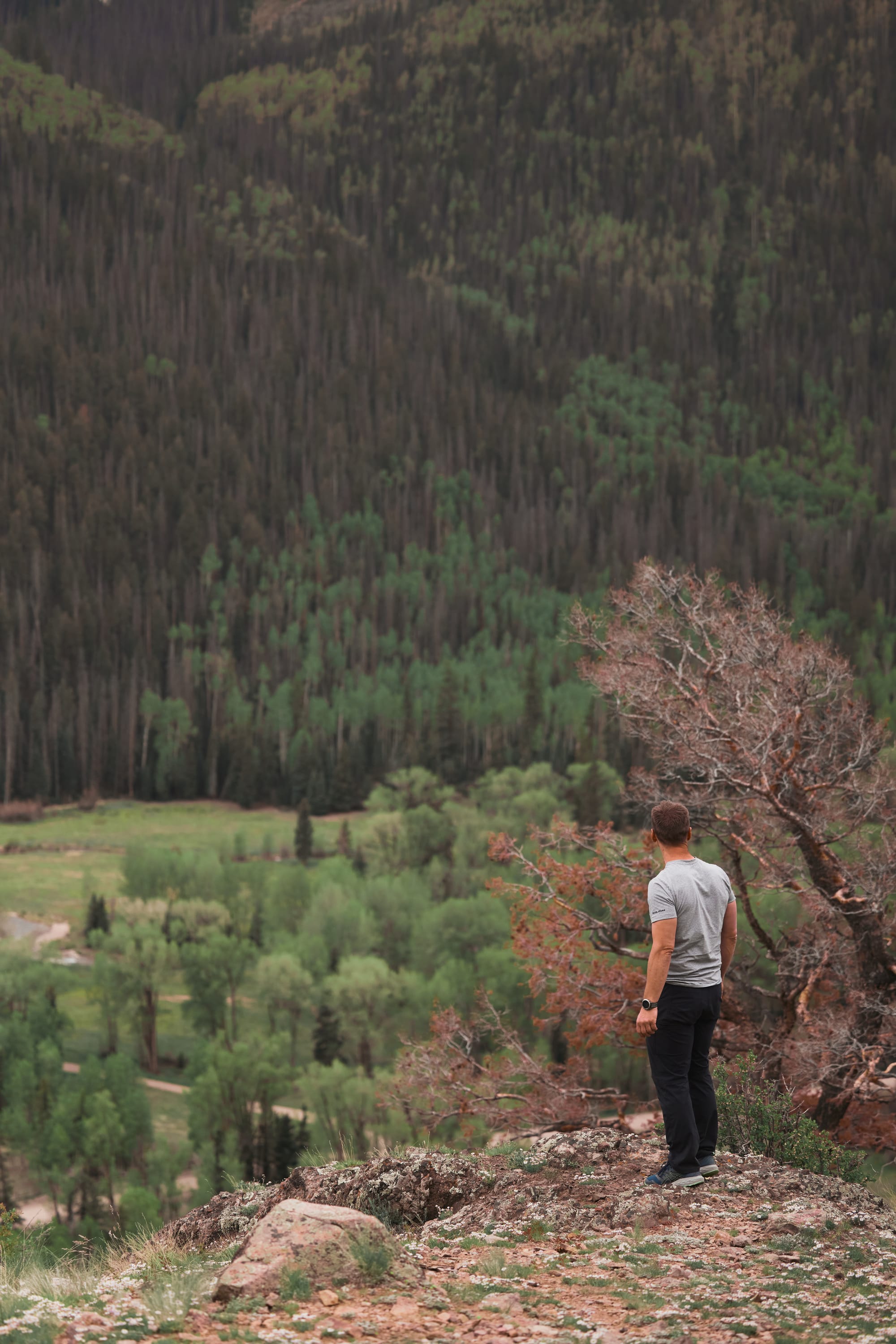
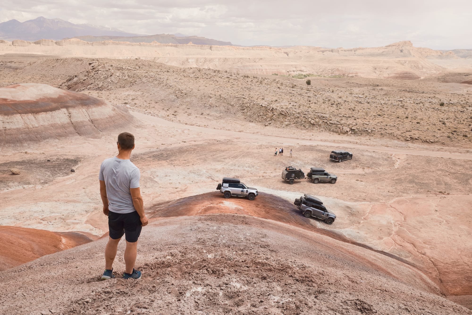
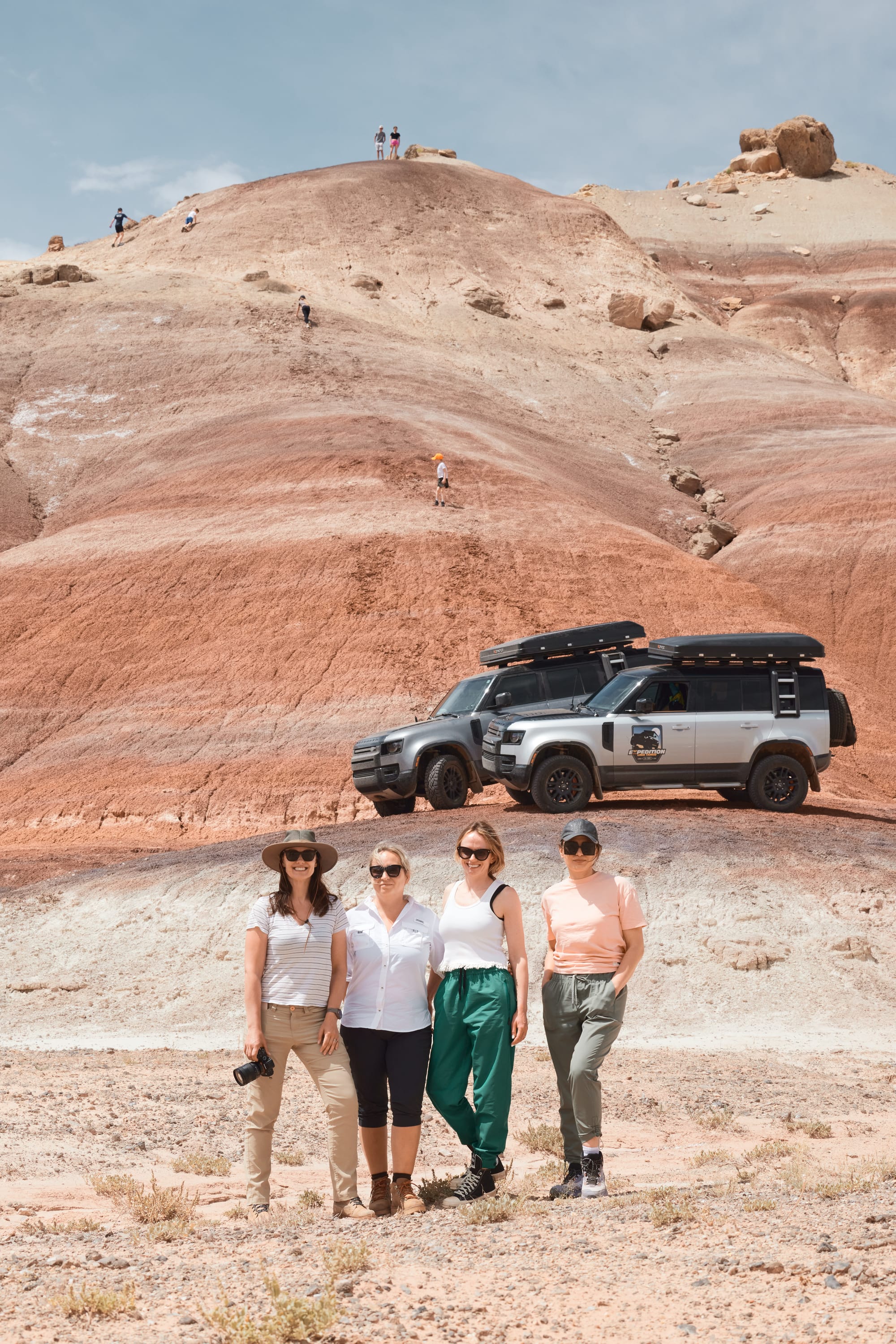
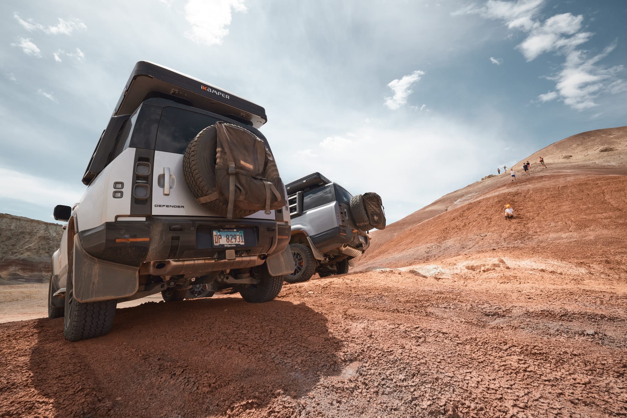
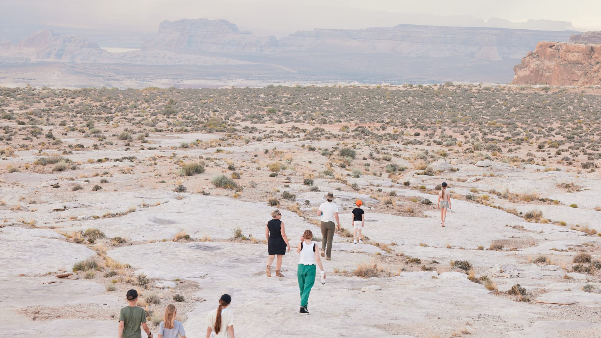
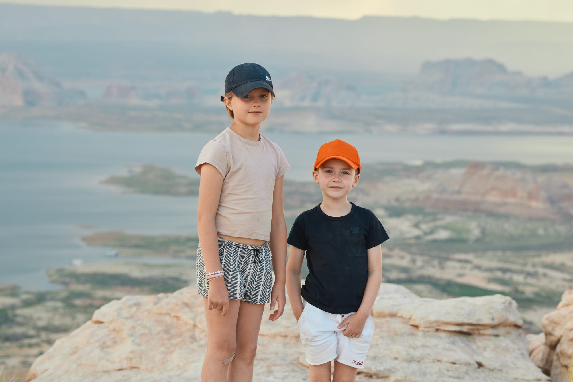
This is my third time overlanding in Utah and I still get awestruck at how rapidly our surroundings shift from dense green underbrush, to sandy hills, to saturated and jagged red crags that would fit better on Mars than on Earth. Our pace is slower today and we explore a few trails on our way that are surrounded by surreal, colorful, and layered hills that managed to somehow escape a Picasso painting. The hills look solid enough for our boyish stupidity to overtake and attempt a few questionable climbs in the Defenders. As soon as kids spill out of the cars we see patches of color scrambling up the surrounding hills, interrupted by concerned instructions from moms below, hands shielding their eyes. The vehicles are staged for a rapid photoshoot and then we're packed in again and on the way to Escalante.
With a population of 700, Escalante sits nested between multiple National forests and wilderness areas. It serves as an island of provisions for myriads of hikers, overlanders, and wilderness lovers. Our vehicles scatter like a pack of marbles in pursuit of water, fuel, provisions, and a few cups of proper coffee before another dive into familiar and dusty trails.
We head South from Escalante, taking the long way to Lake Powell. Adjustments to our route and delays we have experienced will require us to establish camp before we reach Lake Powell. I pull up the trail on Gaia and mark all potential camp locations based on topographic data, evidence of streams, and interesting landmarks. Rocking along the trail we meet head-to-head with two modified Sprinter vans – knobby tires sticking out to the sides, thick intake chimneys raised close to the roofline, mud and dust caking the sides. We slow down and chat with the adventurers. One of the gentlemen is from Switzerland – vehicle and all, and has spent the last six months traversing various trails throughout the continental US. They inform us that a storm caught them on the trail the previous day and forced to stop for camp. It sounds strange to us – rain has never slowed us down and we wonder what type of terrain awaits us further down the path. We exchange pleasantries and continue.
The landscape is covered by a dense, thorny bush. As the sun sinks toward the horizon, we pass a few of the sites I have researched, but none have sufficient clearances to get all of the vehicles in. A dried-out riverbed follows our path Southbound, trucks dipping in and out of the sandy depression. I ponder what this would look like with water in the river and whether a crossing would be possible in a different season. After an hour of driving, we realize that no other car had passed us. Finally, we approach a kink in the river that is encased with a rocky formation on one bank and an easy slope on the other. A stream trickles in the middle of the riverbed and multiple other streams drip down the face of the rock – good location both from a shelter perspective and running water to wash dishes, shower, etc. Two of our trucks settle directly in the riverbed, two others are balanced out on the bank, camp and cooking station in the middle.
The water, unsurprisingly, smells of iron, filtered through the bright red soil. Using advanced scientific methods (by smelling it) we decide it is safe enough for washing. This is a peaceful evening and as we cook dinner by the fire kids play with the stream, build art installations from rocks in the riverbed, use torches to stage shadow theater, and conduct "experiments" with calcium sediments they find on the wall of the cliff. A discovery of a potato bug almost makes us call in a napalm airstrike on the area, but a quick wiki lookup assures us this alien looking creature is harmless. Research at risk of losing sleep the next couple of nights.
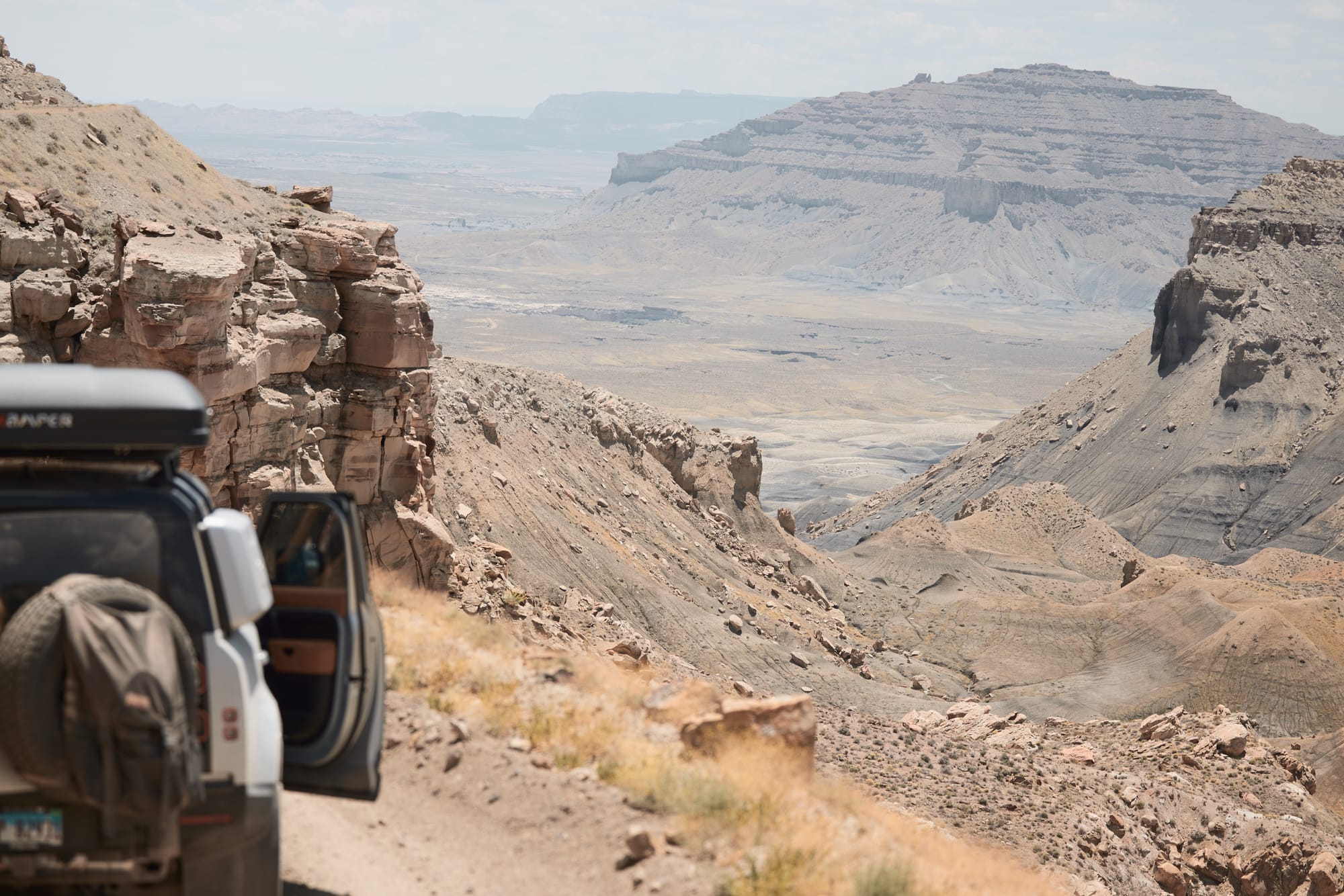
We sleep well, however. Back on the trail we finally climb out of the thorny canyons and the landscape opens in all directions, no sight of roads or towns as far as the eye can see. This is a desolate place, painted in yellows and grays, affording life only to small shrubs and wildflowers speckling the landscape in saturated droplets of color. At the bottom of rolling canyons, we see yellow etch marks crisscrossing every which way where rivers used to flow. It's June now, however, and temperatures north of 100 degrees Fahrenheit are a persistent reminder why we're hauling tens of gallons of drinking water across this parched land. Breaking down without water here is downright dangerous.
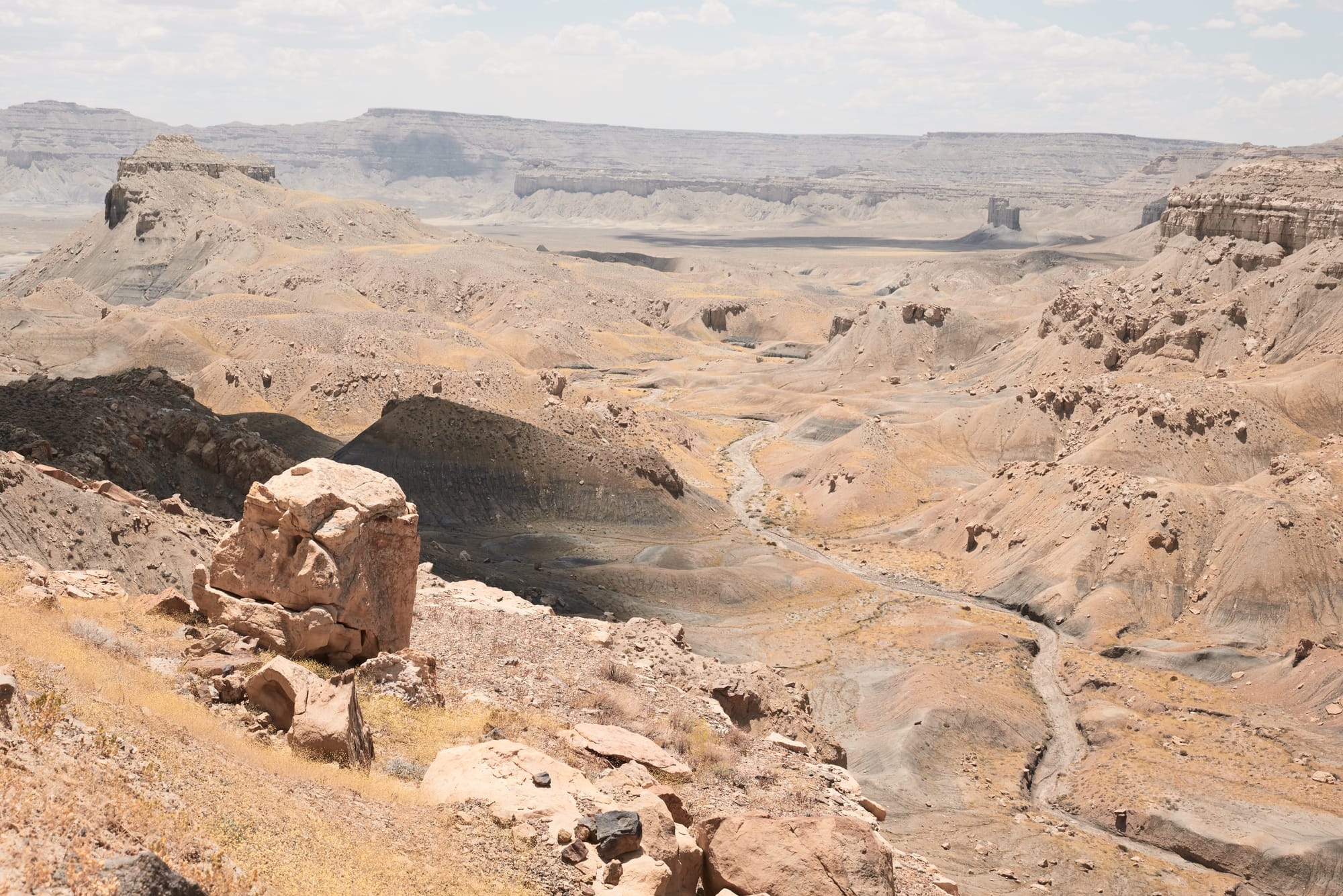
While the trail is mostly even, we do see multiple areas where water runoff has carved into the path. On steeper descents we notice long skid marks left by other vehicles and start piecing together why our Swiss friends decided to camp during the rain. While trails in Moab are mostly solid rock and tightly packed gravel, the path we're on now is a mixture of sand and dried mud. Based on the skid marks we can tell the Sprinter vans were sliding all over trying to navigate the trail and avoid the falloffs during wet conditions. The sky is blue now, however, and puffy clouds float lazily above four trucks carving their way towards Lake Powell.
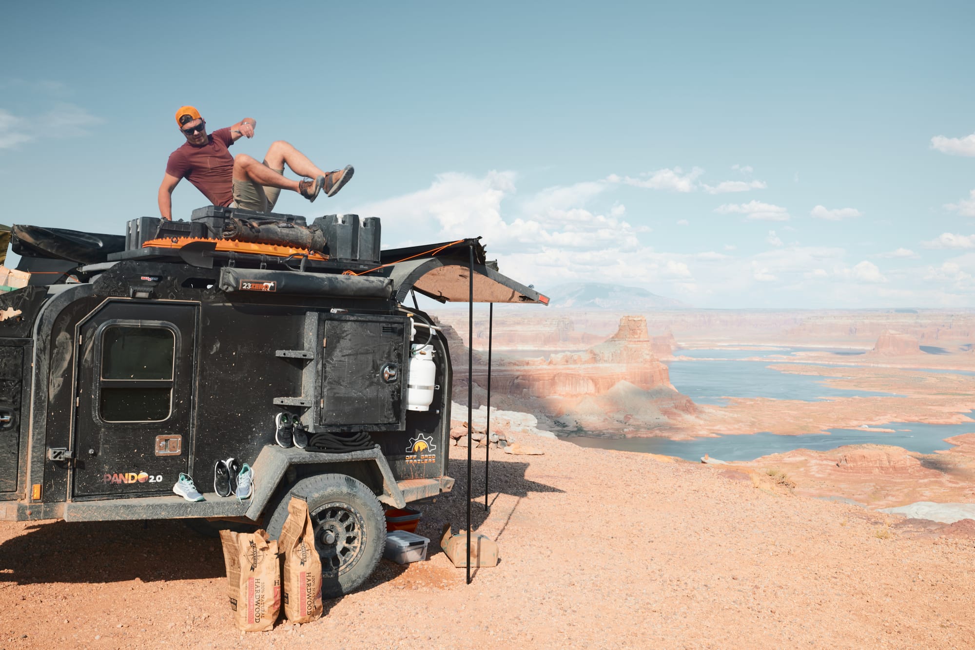
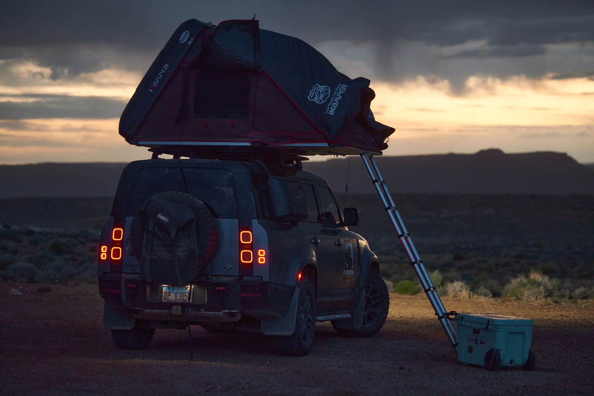
Our destination for today is Alstrom Point, a dispersed camping site perched a thousand feet above Lake Powell and one of the southernmost locations within the state prior to crossing over to Arizona. We've covered a good chunk of trail yesterday and arrive on location with the scorching sun high in the sky and plenty of time to configure camp, hike around the area, and cook ourselves a lavish meal. Having spent just a few minutes outside the air-conditioned cabins we make a wise decision to extend as many of the shelters and tents we've brought with us. We manage to untangle the most complicated awning made by man on Martin's trailer – fixed in placed with multiple vertical posts and spider webs of bright red rope that require fancy nautical knots to tie things into place. I swear under my breath as I use overhand knots everywhere… meanwhile Vaidas unpacks his stadium sized tent that he probably bought at Menards. It features a thousand aluminum legs and could serve as shelter for multiple refugee families, but we set it over our dining table to provide shade for our salami, pickles, beers, and ham.
We go for a short hike around the edge of the canyon to observe the lazy curvature of the Colorado river as it continues its journey South. A layer of thin clouds has hidden the sun, and everything gets painted in an eerie yellow cast, reflective light picking up the color of rock under our feet. We notice another truck in the distance, slowly rocking over the stone path that leads to camp and are thrilled to realize it's the missing Defender and its banged-up crew, back with a blessing from a doctor in Moab. One moment the flock of kids carefully examines Sebas' new haircut and bandages, the next they're all back to making noise and playing games as if nothing ever happened.
The sky is overcast now and we're grateful for the cooling breeze – we'll miss out on the sunset, but at least the evening will be pleasant. There's a storm brewing on the horizon and I have a flashback to a prior trip with Dominic where we thought the gale would rip our tents off the trucks, but surely that's not the case for today. Summoning the advanced knowledge and tooling of a pilot, Dominic pulls up the meteorological radar on his phone and declares that the storm is indeed moving in parallel to our current location and that there's "less than 5% chance that the edge clips our camp". A bet is wagered on said prediction.
A gust of wind shakes our five square miles of tenting as the dark blue clouds extinguish the last rays of the sun. Sipping a beer with one hand, I hold the aluminum tent pole with the other to reduce the agitated flapping. Martin's hat is ripped off his head and sent towards the chasm of the canyon, followed by our laughter as Martin scrambles to catch the evasive prey. There's more of us now holding on to the tent as the wind speed picks up and we jokingly try to calculate the combined mass of our crew and the force necessary to paraglide Vaidas' tent. After a few chairs are dragged away by the wind, kids decide this adventure is best left to the adults and, unsheathing their iPads, clamber into one of the trucks to resume their activities undisturbed.
The wind is so strong now that the tarp cover gains independent intelligence and decides to abandon the aluminum frame. With fierce instructions Vaidas tells us to hold on to the frame while he untangles the fancy nautical knots as the rest of the chairs, pots, cans, and instruments awaken to their own purpose and plan escape. We're unsuccessful in our rescue attempt. A strong gust of wind jerks the tent violently and several of the aluminum supports bend beyond assembly, the object resembling a steampunk tumbleweed with the cover off. Vaidas hauls the injured parts away from the camp and stuffs them into a rock crevice to prevent an airborne assault.
We feel humidity in the air, then feel a few drops of rain. Then it starts pouring, horizontally. We had positioned our vehicles to face the canyon for romantic views upon sunrise, but that also means that a couple of the trucks have tent openings facing directly into the rain. Martin opens the metal back of the trailer for shelter while there's a mad scramble within the camp to reorient the Defenders, collapse tents, and salvage loose items that continue their crawl towards the abyss. Rain is everywhere, the wind kicks it around corners, and I'm happy I'm wearing my Arc'teryx shell. Someone recalls Dominic's weather predictions and comments on lesser likelihood of flying together in the future. Throughout torrential rain, chaos, and wind a few bottles of libation surface from the depths of Martin's trailer and a glass of whiskey is passed around. A bottle of champagne is dispatched to the vehicle where ladies have found refuge. Bruised, battered, and wet we're less bothered by the storm now, crowding behind the safety of Martin's kiosk and observing the devastating power of nature pour its wrath onto the plateau of the canyon.

It's almost midnight by the time the rain stops as abruptly as it began. I nudge Vaidas to unpack the grill and we cook the remaining inventory of our hotdogs, burgers, and sausages. We finish our drinks and, tummies full of food, climb into our tents to survive yet another day on the trail.
It's not unusual for kids to get sick on overlanding trips and this trip is no exception. The vestibular apparatus gets a good workout on the back seat and every now and then there's radio chatter requesting a brief stop. In the morning we find out that one of our troopers had a bad night and we decide to alter the route slightly and head south towards Page, stop for a brief resupply, and then start our loop back to Colorado using asphalt. Tonight will be our last night in the wilderness prior to the long cruise back to Illinois. We pack up camp around noon and, sun overhead, creep West and then South out of the Glan Canyon National Recreational Area.
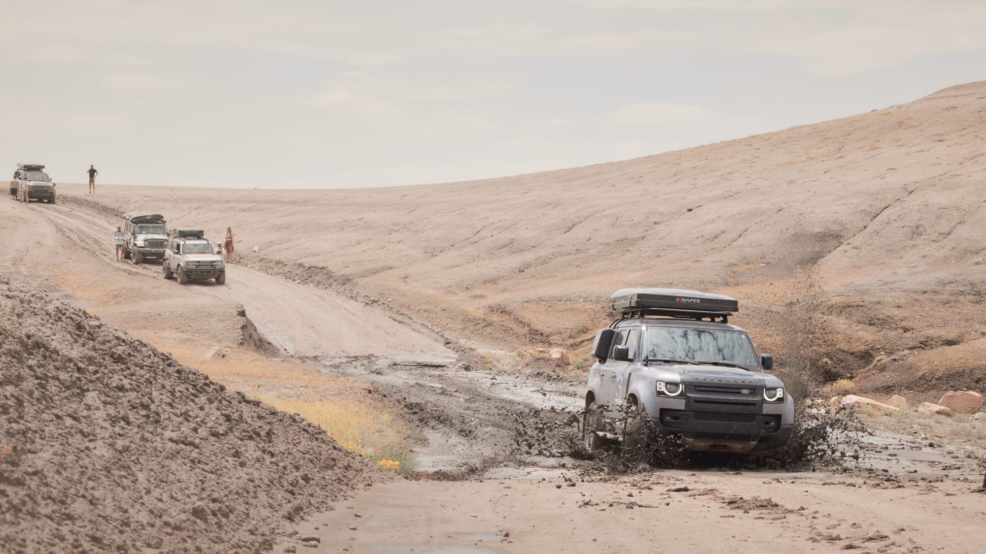
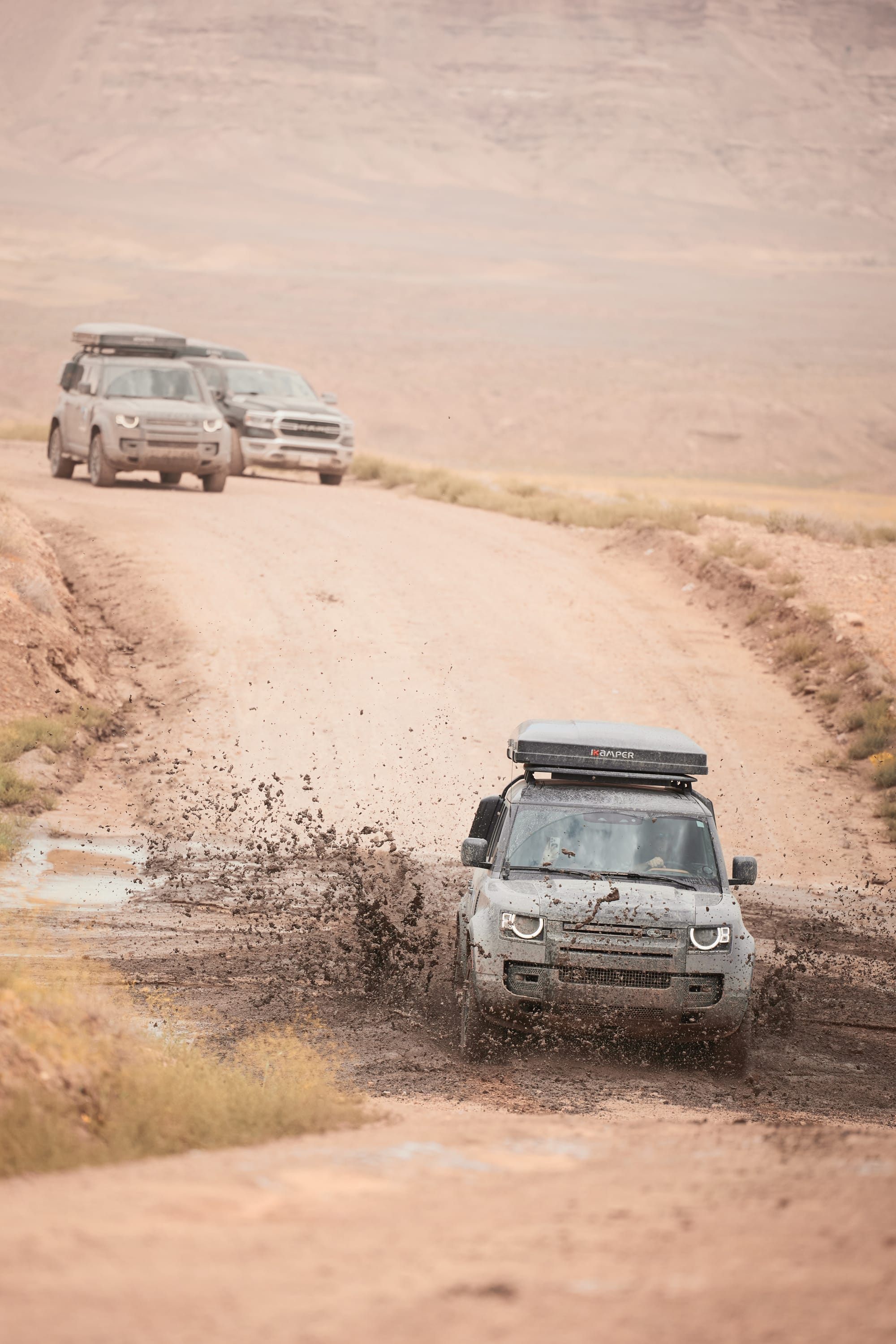
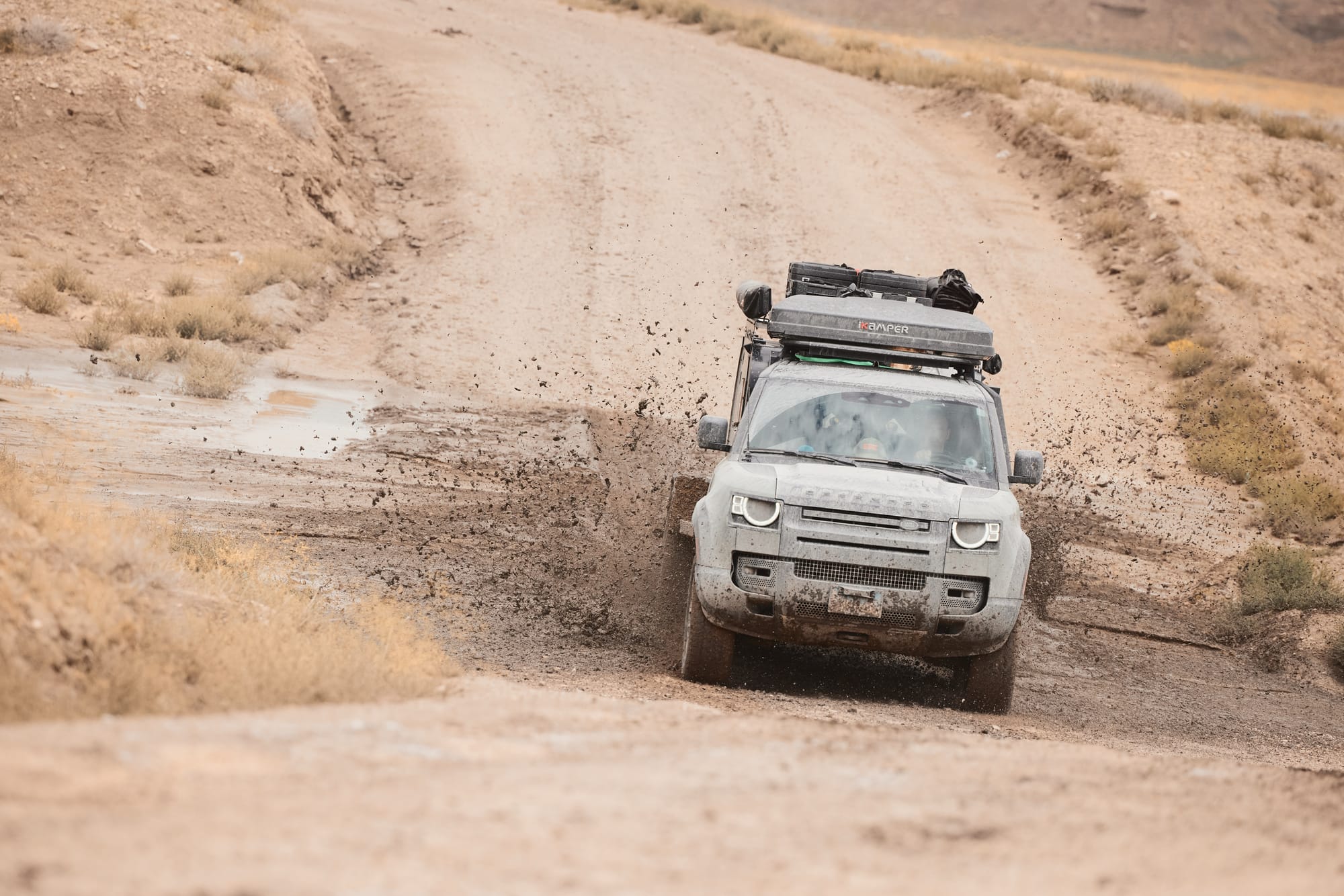
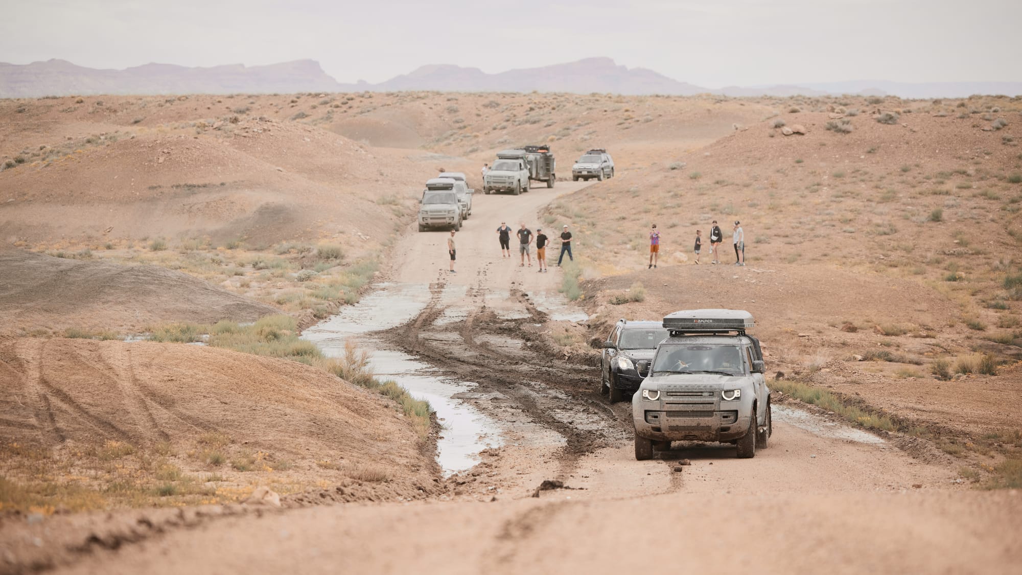
Cresting one of the rolling hills we notice traffic up ahead – a kitted out Jeep Wrangler and a Ford Bronco sit on the side of the trail, the crew scattered around a depression in the road. A young lady is kneeling next to the Bronco and using a shovel to unsuccessfully clean the mud off the wheels, while further down a guy is measuring the depth of a mud rut with his flip flops. We realize that the depression in the road is a runoff area where yesterday's storm must have found the path of least resistance, now filled with, what looks like, a foot of mud. We're slightly confused as to the reluctance of our overlanding brethren to dip into the mud bath, but it is possible they lack needed recovery gear, were things to go sideways.
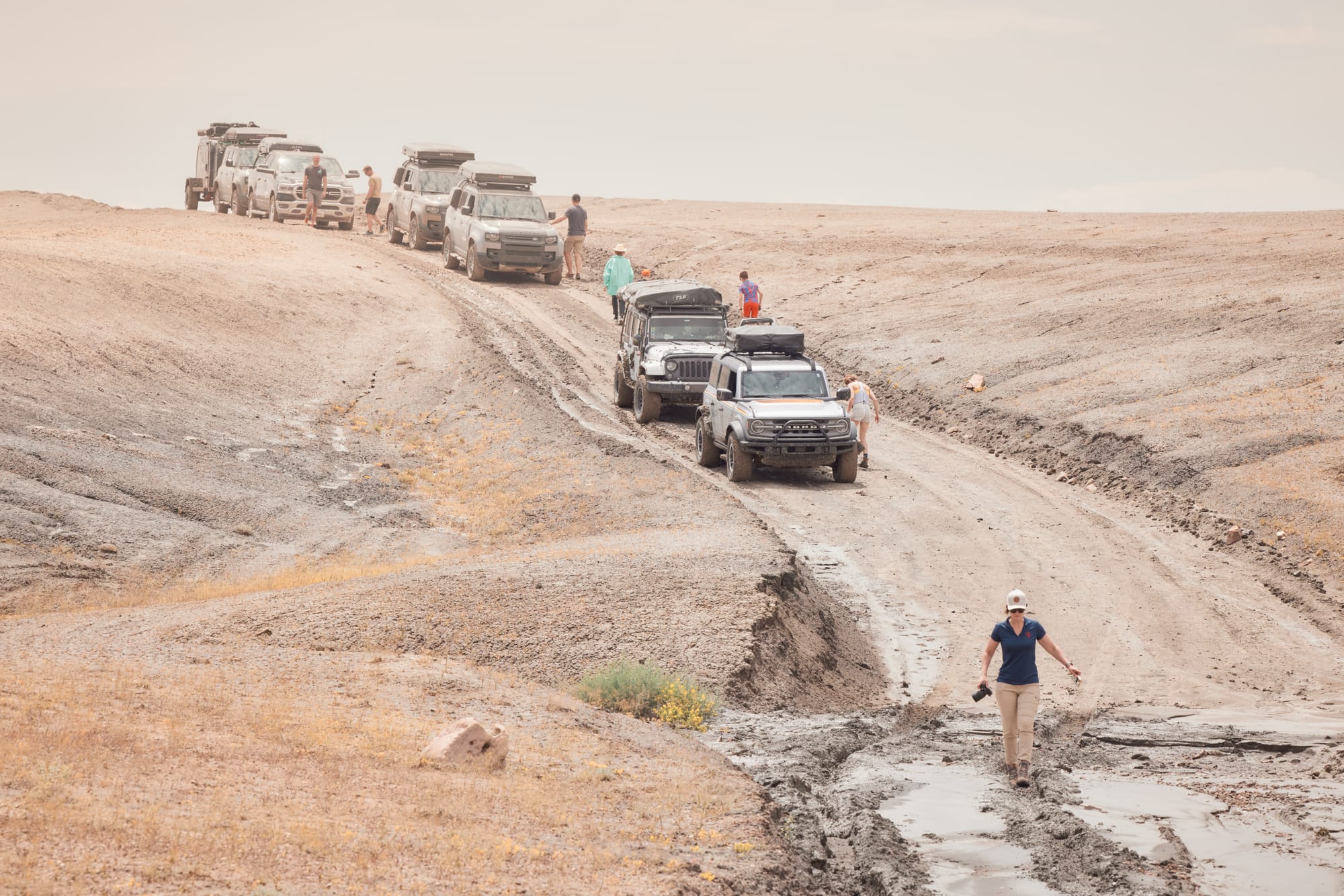
Dominic recommends unloading my passengers and then doing a trial run – if I get stuck, they'll rope the truck and extract me back to the shore. I fondly remember that there's a setting on the traction system for mud ruts, engage the mode, and launch the Defender. One moment I'm debating the amount of momentum to apply while entering the mud, the next there are fountains of liquid earth flying from both sides of the vehicle, the body of the truck oscillating left and right as wheels spin and the Defender swims, rather than drives, on the liquid slop underfoot. I can feel the truck losing momentum as the resistance from the mud fights what little traction exists, but the truck maintains high RPMs and slowly wiggles its way across the puddle, finally clawing onto the dry bank.
Camera in hand I pop out of the truck and take pictures of the waterworks as four vehicles punch through the organic superglue. Vaidas' Ram wades across with the least drama of all – the specialized knobby tires on his truck resemble paddles. Lastly, Martin's trailer has a mind of its own as it tries to jackknife halfway through the rut only to recover a second later and make it across safely. This performance wins Vaidas the position to permanently own the rear of the column in case Martin's circus trailer gets stuck or goes off the path.
The valley we're driving through is crisscrossed by mud ruts and we test various entry and exit scenarios. Sarunas plows into one of the puddles full throttle, sending chunks of mud thirty feet in the air and decreasing visibility on his windshield to zero. Close to civilization now, we approach a crossover Chevy properly beached in one of the puddles, half the fender torn off, wheels spinning and digging itself deeper. A young couple sporting a fierce number of piercings and tattoos tells us they're trying to make it across the plateau on their trip through national parks. Saddened by our own inability to get stuck and use recovery gear, Dominic and I jump to the rescue by combining two recovery ropes and attaching one end to the frame of the Chevy. We tell our ill prepared, vaping new friends that the ruts are even deeper on their intended path and propose to extract them and then turn them around in the direction of safety. They agree.
On the fifth overlanding trip we finally use our recovery gear.
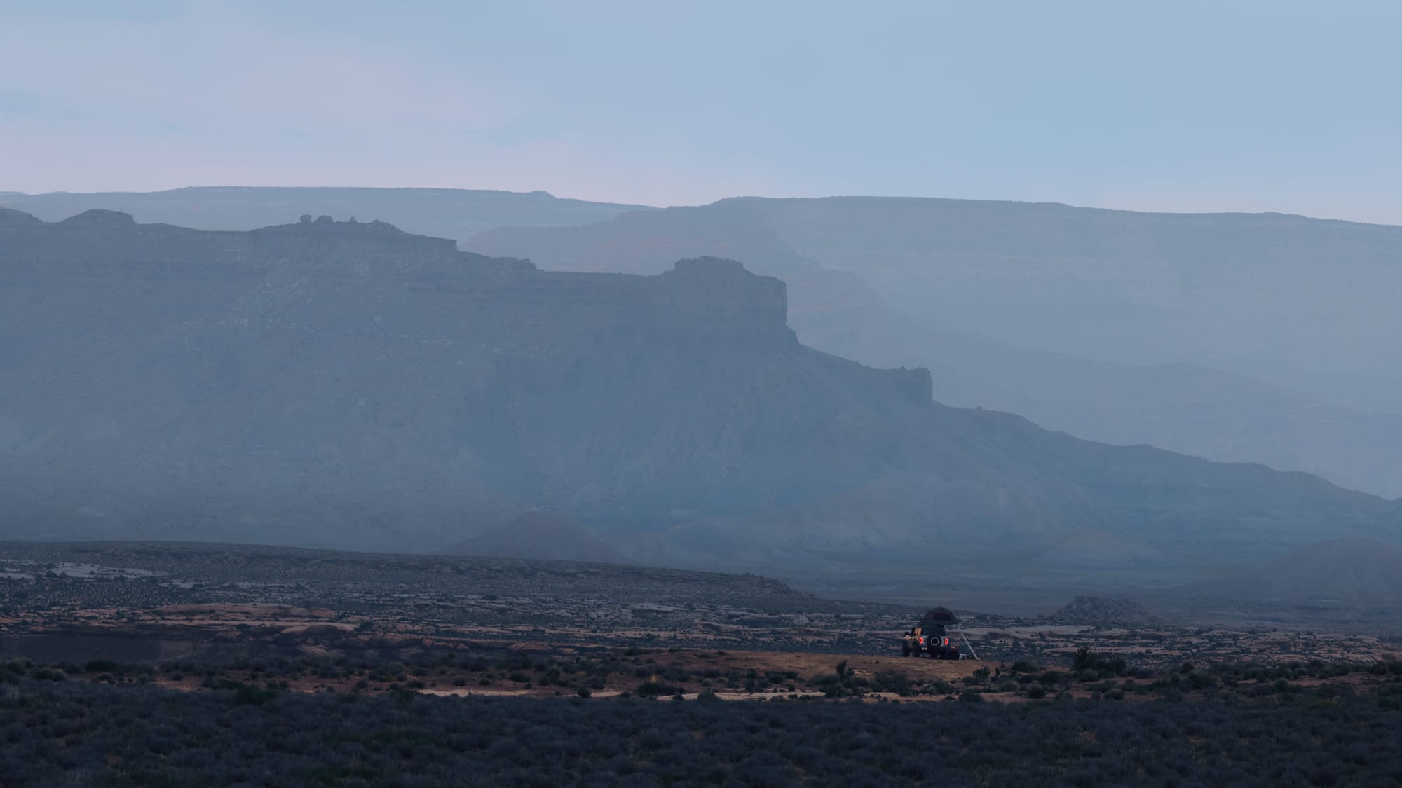
The last night is calm and cool, back at higher elevation in the mountains of Colorado. We reflect that it would be difficult to replicate the undulations of this journey if we tried – avalanches, mud baths, accidents, questionable trail choices, and wild thunderstorms. Overlanding is an adventure of walking a thin line – play it too safe and it becomes dull, push it too hard and there's a risk of having to abandon the trip altogether. We came awfully close to the latter, multiple times, eking through by sheer luck, good planning, and a reliable team. We may anticipate various scenarios, but some variables are thrown in by mother nature, always with a mind of its own. At these most uncertain of times I am glad we have this group of friends.
Driving home through the Rockies, a massive snowstorm turns day into night and ejects two inches of hail on the twisty mountain roads. We creep at twenty miles an hour, windshield wipers furiously battling at the elements. An unfamiliar vehicle attempts an overtake, loses control, and slides sideways across the whole road. We may be done with this trip, but nature isn't done with us.
The end.
Decided to bring the Canon R5 and a bunch of glass on this trip. Not like I was gonna have to carry it...